
The Wave
Coyote Buttes North, AZ
THE WAVE
A BRIEF SUMMARY OF THE WAVE
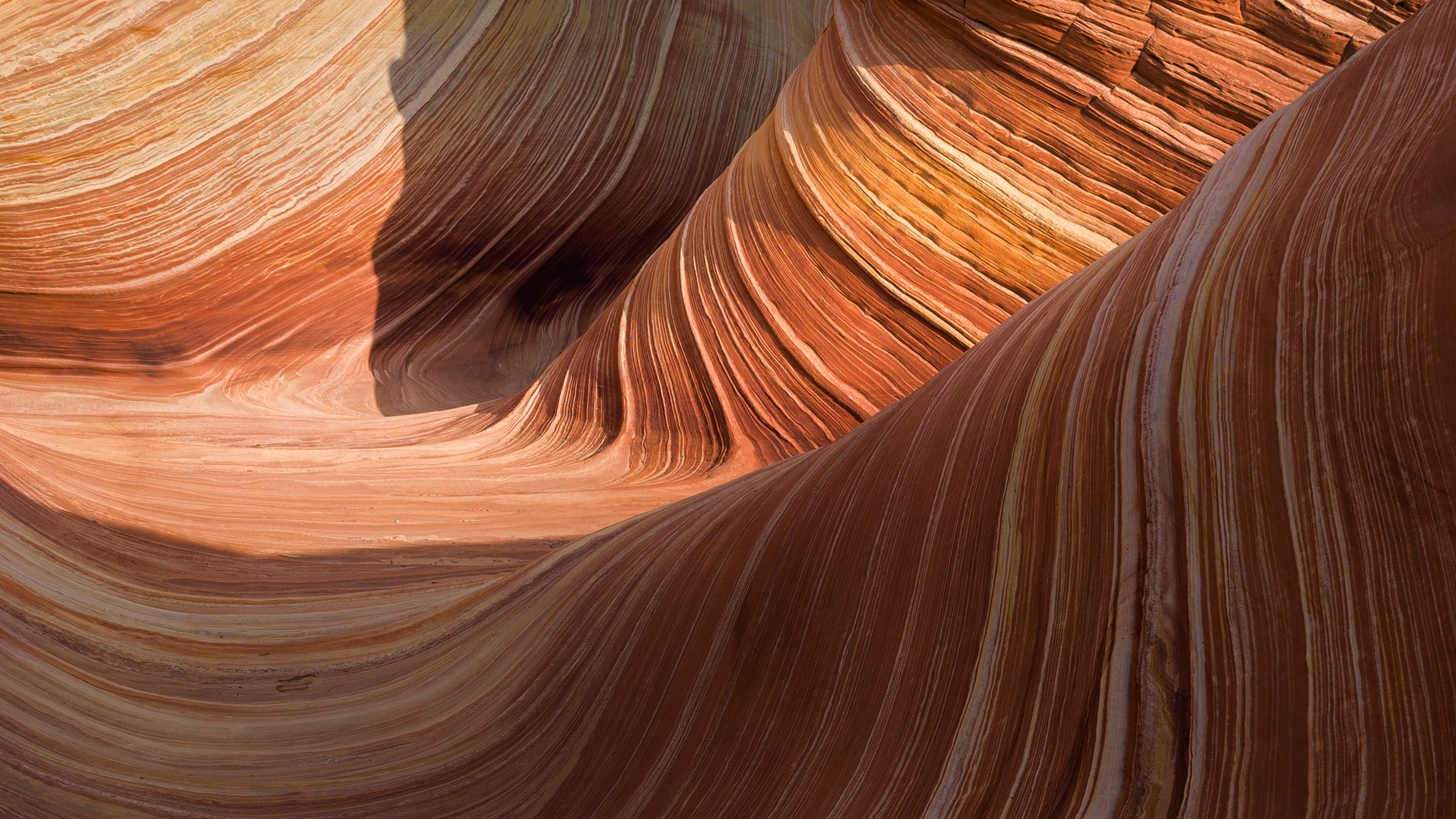
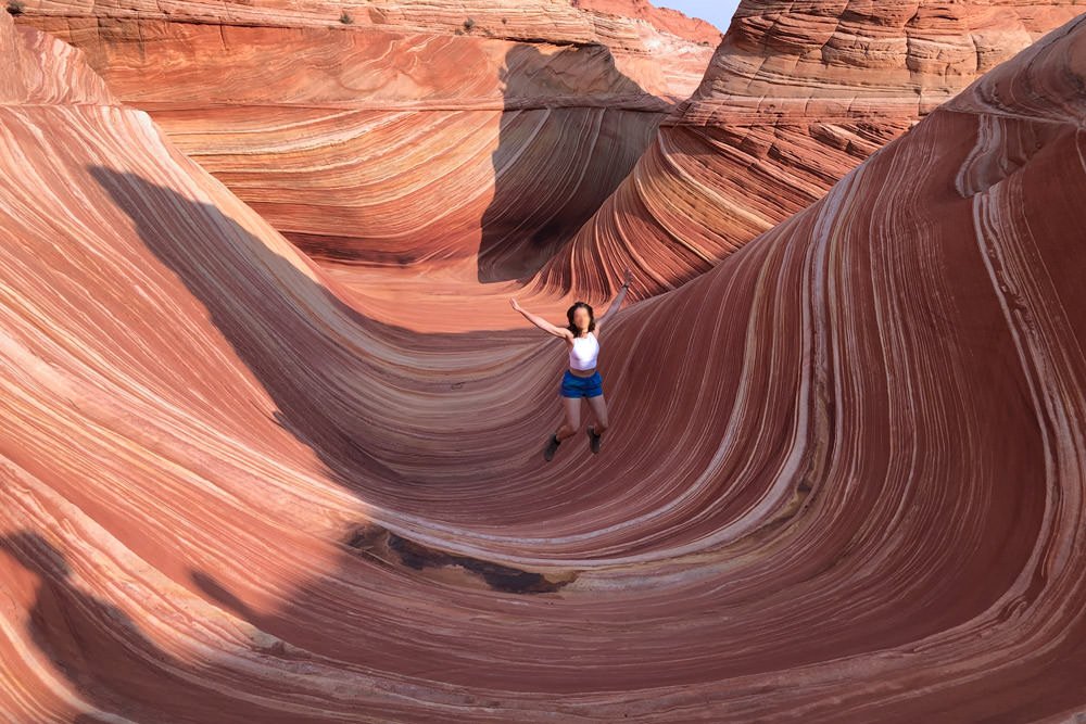
The Wave is one of the most intriguing and sought-after locations to visit and photograph in the American Southwest. And for good reason, this natural wonder is truly unique and like no other place in the world.
I have visited many fascinating places in my life, but only a few are as mesmerizing as this little sandstone bowl in the middle of nowhere. When you first arrive at the Wave, you will spend several minutes taking in the wonder of the place, trying to reconcile how it ever came to be. And the memory of the many times you tried to get a permit, the cost and effort of the trip, and the butt-kicker of a hike it took to get there are washed away.
And yes, it’s spectacular!
There are hundreds of articles, videos, and websites documenting the journey and what is needed to get to The Wave. This summary is focused on photographing this once-in-a-lifetime opportunity.
The Wave and the sandstone rock formations are delicate and fragile and receives many visitors each year. I would ask that when you visit, please do your best to preserve all aspects of this location for future visitors and always try to leave it in better shape than when you found it.
Images and location summary by Tim Wier

Annual Subscription
Lifetime Membership
DATA POINTS INCLUDED WITH THE WAVE SUMMARY
I would rate the difficulty of this trail as a 4.5 on a scale of 1-5 (with 5 being the most difficult).
The drive to the Wave parking area on Houserock road from HWY 89 is bumpy, sandy, and can be impassable when wet but can be made in most vehicles (when dry).
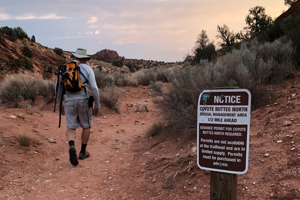
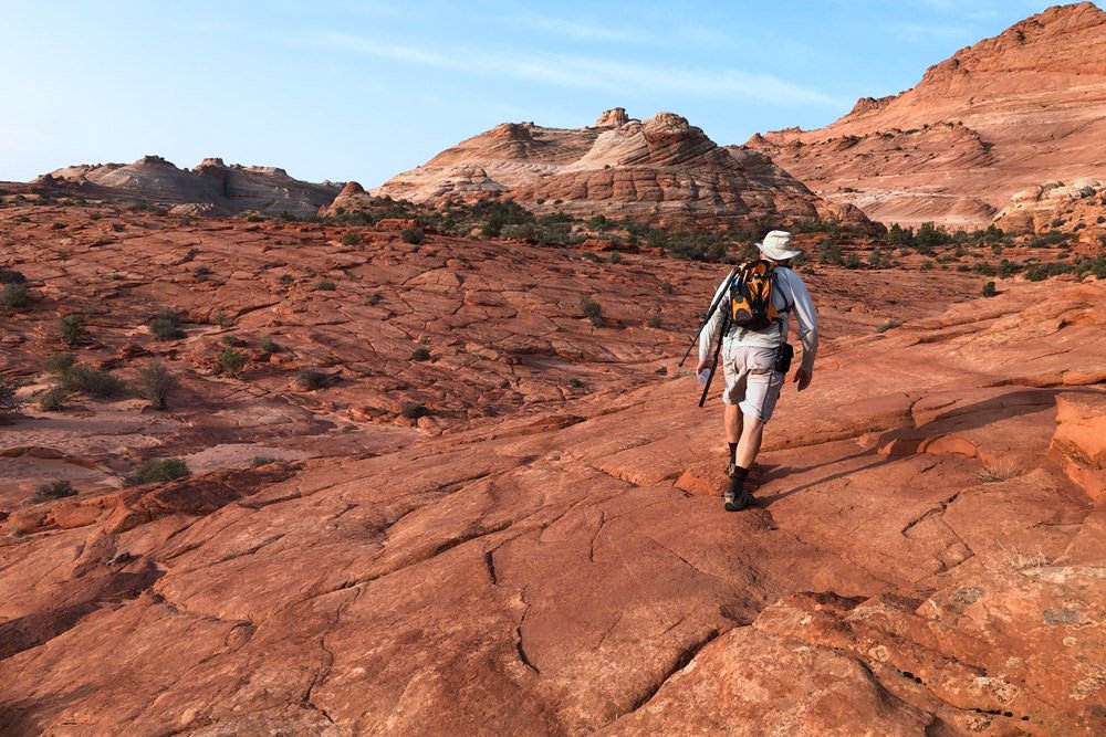
The trail to the Wave is roughly 3 miles each way (6 miles round trip) + the extra walking in and around the other locations at Coyote Buttes North. However, this is no walk around the neighborhood. The hike to the Wave is HARD as you will be going uphill/downhill 5 or 6 times (with large elevation gains), walk through deep sand and hiking on uneven, steep and slanting slick rock for much of the trip. And the last leg of the hike (just before getting to the entrance to the Wave) is the most challenging part - with a nasty 45 degree uphill hike in DEEP sand. This hike is not for everyone and should not be attempted unless you are in good shape.
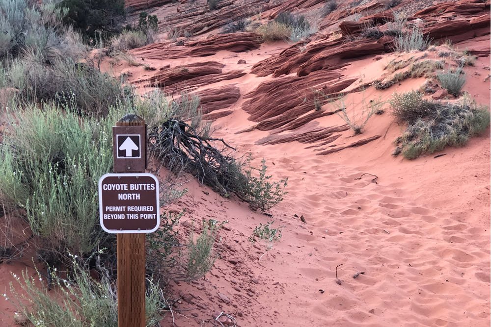
The majority of the hike is totally exposed, with very few places to hide from the sun. When taking this trip in the Summer, make sure you have at least 3-4 quarts of water, snacks, and head covering. Timing for the hike is between 1 1/2 to 2 hours each way (depending on your pace). The BLM placed several signs/markers on the pathway- but you can still get lost and disoriented, so I strongly suggest downloading a KML file to the Wave and using GPS tracking software to stay on the trail.
Once you finish the hike, you will be worn out, exhausted, triumphant, and feel like you have achieved a mental "badge of honor."
Before describing the nuances of photographing The Wave - let me first define a few terms, locations, and other points of interest:
Coyote Buttes North is part of the Paria Canyon-Vermilion Cliffs Wilderness, and has some of the most visually striking geologic sandstone formations in the world, including The Wave.
The Wave - is a small bowl-shaped area of colorful and twisted sandstone strata which …
As mentioned, the hike is difficult, so you want to pack as little as possible. If you are planning to shoot the classic Wave shot, you will need an ultra-wide-angle lens (14-20mm). However, if you are going to shoot abstracts and wave formations, you will need a standard to a …
5,210 Ft. Elevation
Other Resources Available with Membership
KMZ Trail File
Directions
Best Time of Day to Shoot
Best Time of Year to Shoot
Equipment Needed
Permits Required
Direction of Shot
Google Maps Birds-Eye-View
Number of Photographers to Expect
Cell Service
Overnight Lodging/Camping
Nearby Restaurants
Area Guides and Workshops
Other Resources
LOCATION SUMMARIES WRITTEN BY PROFESSIONAL PHOTOGRAPHERS


