
Delicate Arch

DELICATE ARCH
Arches National Park, UT
In my opinion, Utah is the most photographic state in the county - with countless opportunities to view unique shapes, arches, mesas and buttes. But only one scene was chosen to be on the license plate of the state of Utah – Delicate Arch.
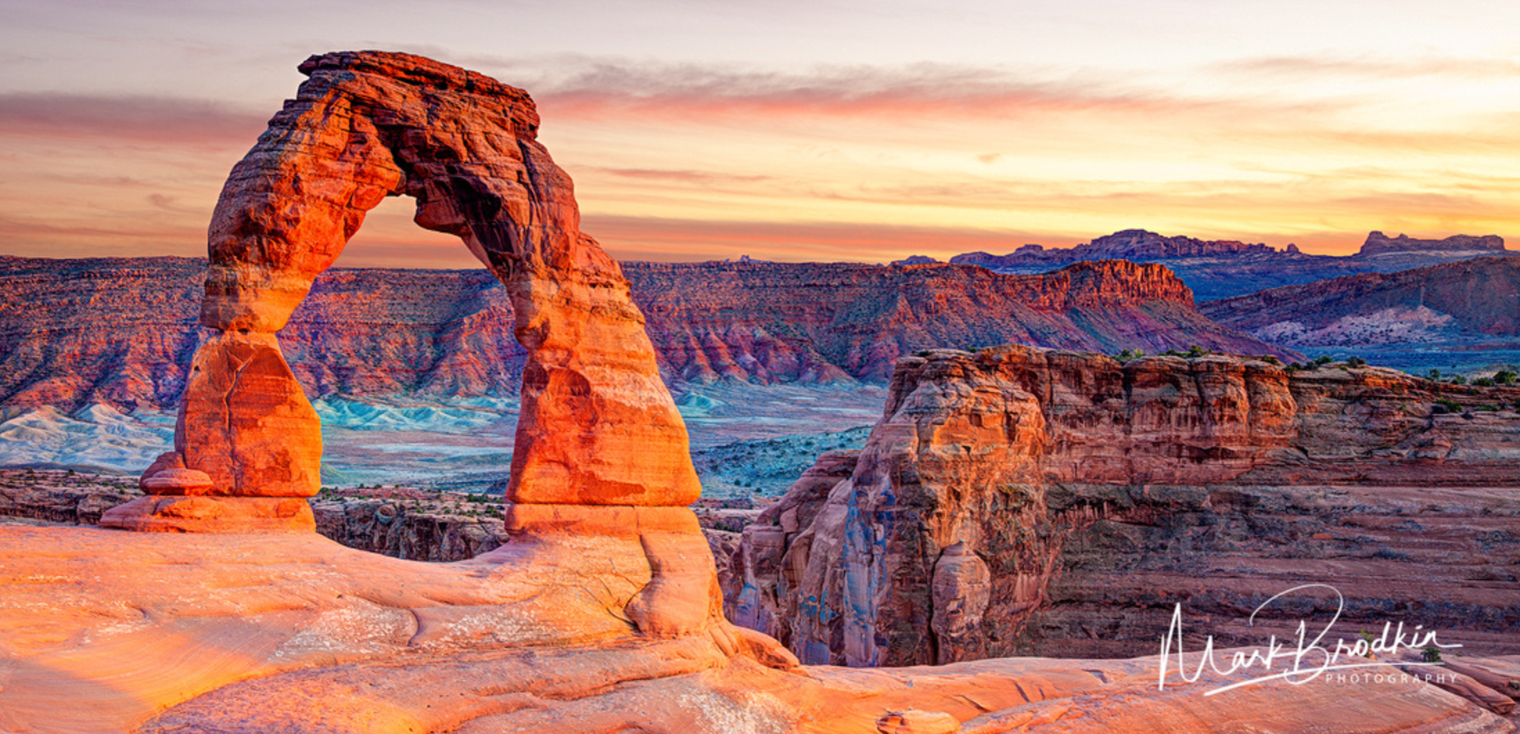
This 60ft tall arch is one of the most famous arches in the country and is one of the most iconic symbols of the American southwest. And as famous as Delicate Arch is, it is even more impressive in person. After the strenuous 1.6 mile uphill hike, you will find yourself wondering how this perfectly shaped arched (perched by the edge of a cliff) happened. This is truly a special place to visit and photograph.
Images and location summary by Tim Wier
Trail Difficulty - CHALLENGING
I would rate the difficulty of this trail as a 3 on a scale of 1-5 (with 5 being most difficult). The 3.2-mile roundtrip (the first half is mainly uphill) hike to Delicate Arch is strenuous to most people and should only be done with the right precautions.
GPS Coordinates & Elevation
4,739ft Elevation
Google Earth
Download KMZ Trail File
Click Here to download the KMZ file for this location.
Directions
CLICK HERE to get driving directions to the Delicate Arch Trailhead Parking Lot.
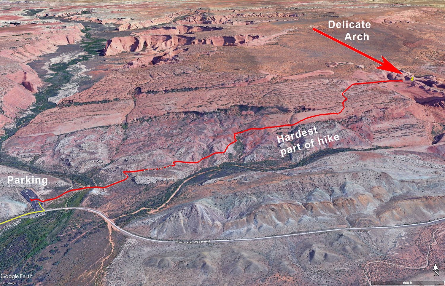
Delicate Arch in located in the Arches National Park (just a few miles north of Moab, UT). The directions are from Moab: Drive northwest on US 191 from Moab for approximately 4.5 miles and turn right onto the Arches National Park on Arches Entrance Rd. Go past the visitors’ entrance and continue on Arches Scenic Dr. for 12 miles and take a right onto Delicate Arch Rd. Stay on this road for 1.2 miles and take a left into the Delicate Arch Trailhead parking lot.
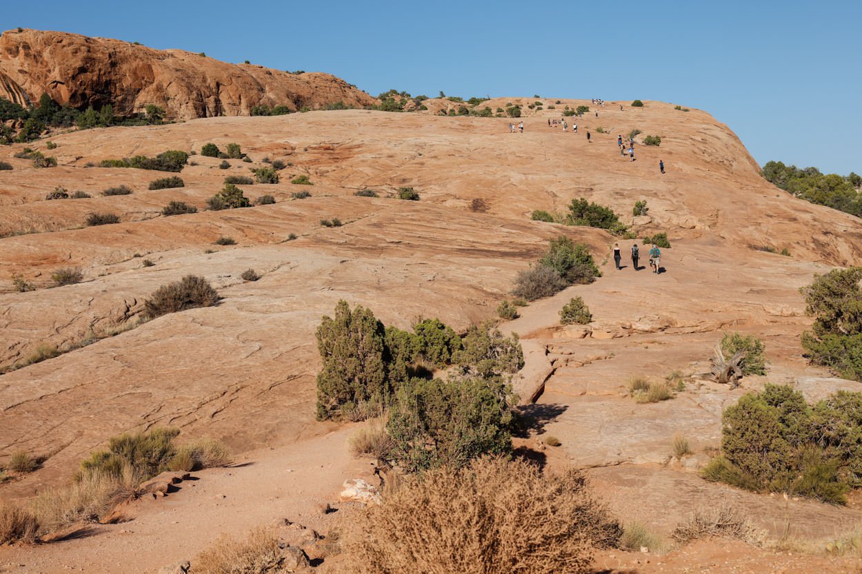
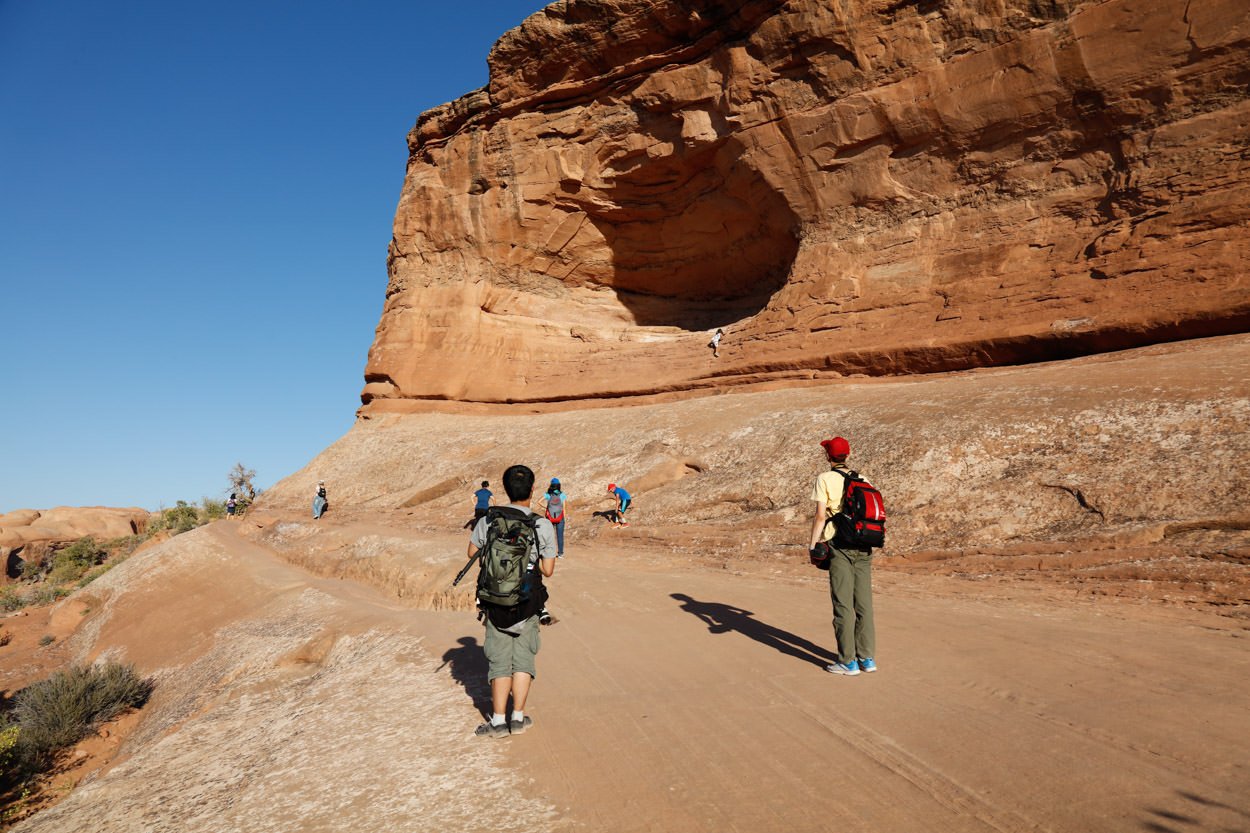
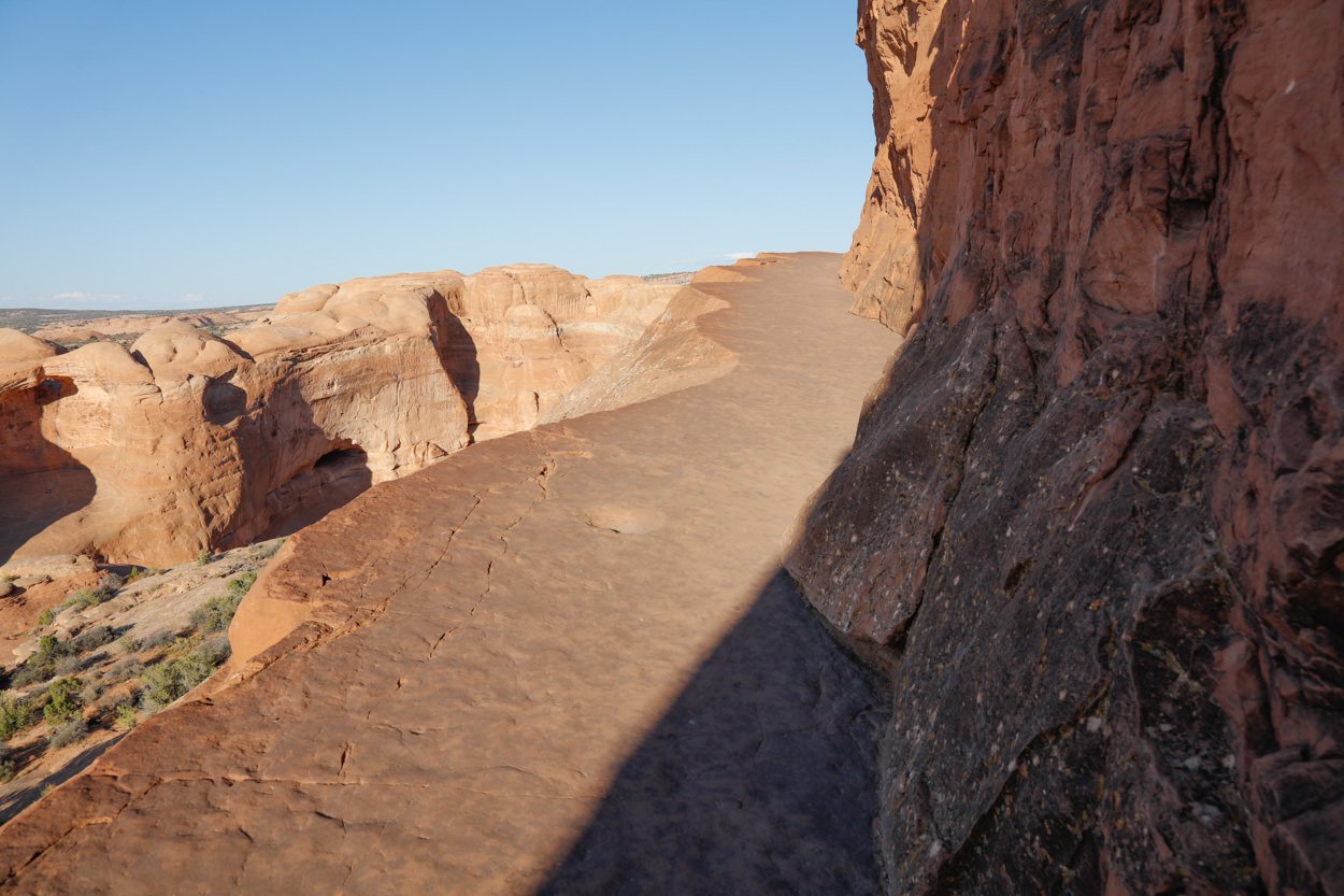
This hike to Delicate Arch is steep and about 1.6 miles from the parking lot (3.2 miles roundtrip) and is not for everyone. If you are not in good to great shape - you may want to pass on this location.
From the parking lot walk up the trail.
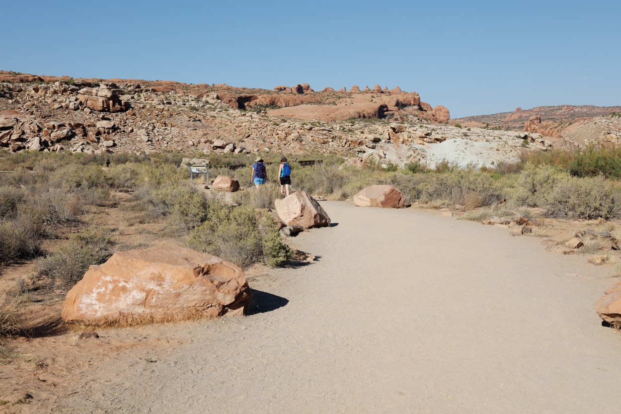
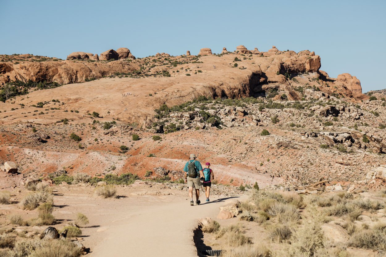
The slopping hill is steep and is a pretty tough hike. Just take your time and pace yourself. At the top of the sloping hill, stay left to find the path to the arch.
Photography Tips
This shot is pretty straightforward - but the key is to keep the horizon level while trying to make the arch to look normal. This would seem easy and obvious, but the arch is not vertical and most times a photographer will compose the shot to keep the arch legs straight - which often times will throw off the horizon.
Remember in your composition, the horizon is straight - not the arch.
EXIF Data
Focal Length – 40 mm
Exposure – 1/15 th sec @ f 8.0
ISO – 100
Date – Feb 7th
Time – 5:49 pm
Other Images From This Location
Best Time of Day to Shoot
Most photographers prefer this location for late afternoon to sunset, as the soft late sun accentuates the red sandstone. The shot above was taken a few minutes before sunset. I have also seen some very nice shots of Delicate Arch at dawn and sunrise.
Another option is to shoot this location at night to capture the arch with stars and potentially the milky way.
Best Time of Year
This location is great any time of year. Spring, summer and fall are nice times to shoot as there will be a red glow on the hills behind the arch.
During the summer months, the crowds can be difficult to deal with. In late fall through winter you might catch some snow on the hills and mountains behind the arch. I would suggest using The Photographer’s Ephemeris to help best understand the direction of the sunset.
For me, I like shooting this location in either spring or fall for two reasons: the crowds are much lighter and the angle of the setting sun hits the sides of the arch more directly and produces a VERY NICE GLOW. That being said, the shot above was taken in winter with the mountains in the background white with snow.
Lens(es) Needed
There are many compositions you can choose at Delicate Arch. I would suggest arrive at least an hour early and walk all around the arch to pick your composition. You can use lenses from 16mm to 70mm to shoot (depending on your composition).
The shot above was taken with a 40 mm lens.
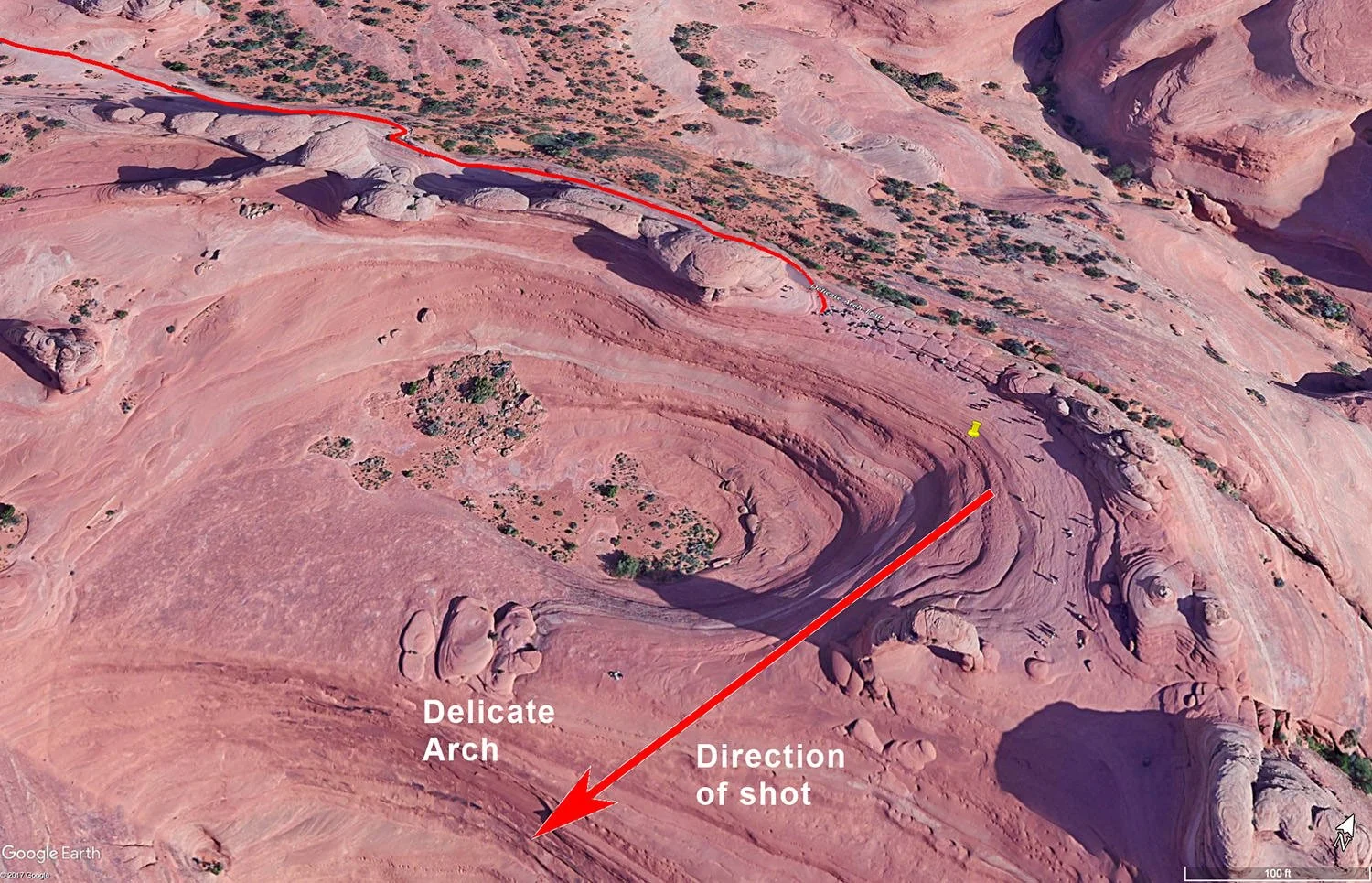
Birds-Eye View From Google Earth Pro
Permits
Once you have paid for the admission into Arches National Park, there are no permits required.
Direction of the Shot
As mentioned, there are tons of compositions at Delicate Arch. The direction of the shot is south by southwest at @ 180° to 240°.
Equipment Needed
Other than a tripod and potentially a polarizer, there is no special equipment needed.
Number of Other Photographers to Expect
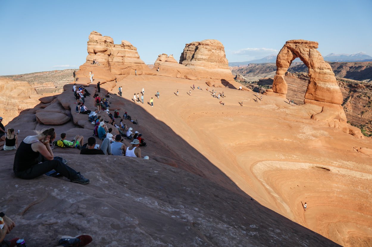
Arches National Park will have thousands and thousands of tourists each day and Delicate Arch is probably the busiest place in the park.
The fall, winter and spring months are the best times to visit to lessen (not eliminate) the crowds.
In the summer, the number of tourist can be overwhelming and there usually is a long line of tourist waiting to get a shot under the arch toward sunset - this can cause frustration and rattled nerves. If you are shooting in the summer, my suggestion is to arrive early, be patient and be prepared to use your clone stamp in Photoshop.
Weather
The Arches National Park is a high desert climate where temperatures can vary up to 30° to 40° a day. Spring and fall are nice, but summer can get into the high 90s. The monsoon season (in late summer) brings violent but brief thunderstorms, which can be great for photography.
Cell Service
I use Verizon, and the cell service in the park is available, but spotty.
Overnight Camping Options
Delicate Arch is in the Arches National Park 5 miles northwest of Moab, UT. Moab is a nice town and has an abundance of lodging.
There are at least 10 campground sites in and around Arches National Park. Devils Garden campground is the only campsite in the park. Most campsites include potable water, picnic tables, grills, and flushing toilets. Some sites will accommodate RVs. An Arches National Park map, available at the park entrance, will provide information on the available campsites.
Nearby camping and lodging
Camping - click on the campground below for directions
Devils Garden campground (18 miles from the park entrance)
Goose Island Campground (north on UT 128 on the Colorado River)
Granstaff Campground (north on UT 128 on the Colorado River)
Lodging - click on the lodging below for a TripAdvisor review
Red Cliffs Lodge
(435) 259-2002
Mile Post 14 Hwy 128, Moab, UT
INCA Inn and Motel
(435) 259-7261
570 N Main St, Moab, UT
Gonzo Inn
(435) 259-2515
100 W 200 S, Moab, UT
Nearby Restaurants
There are no restaurants in the park. Moab, UT, is the nearest town (5 miles) and has a nice choice of restaurants. There are several good places to eat in Moab.
Nearby Restaurants - click on the restaurant below for yelp review
Desert Bistro
(435) 259-0756
36 S 100 W, Moab, UT
Twisted Sista's Cafe
(435) 355-0088
11 E 100 N, Moab, UT
Area Guides and Workshops
None