
The Crack
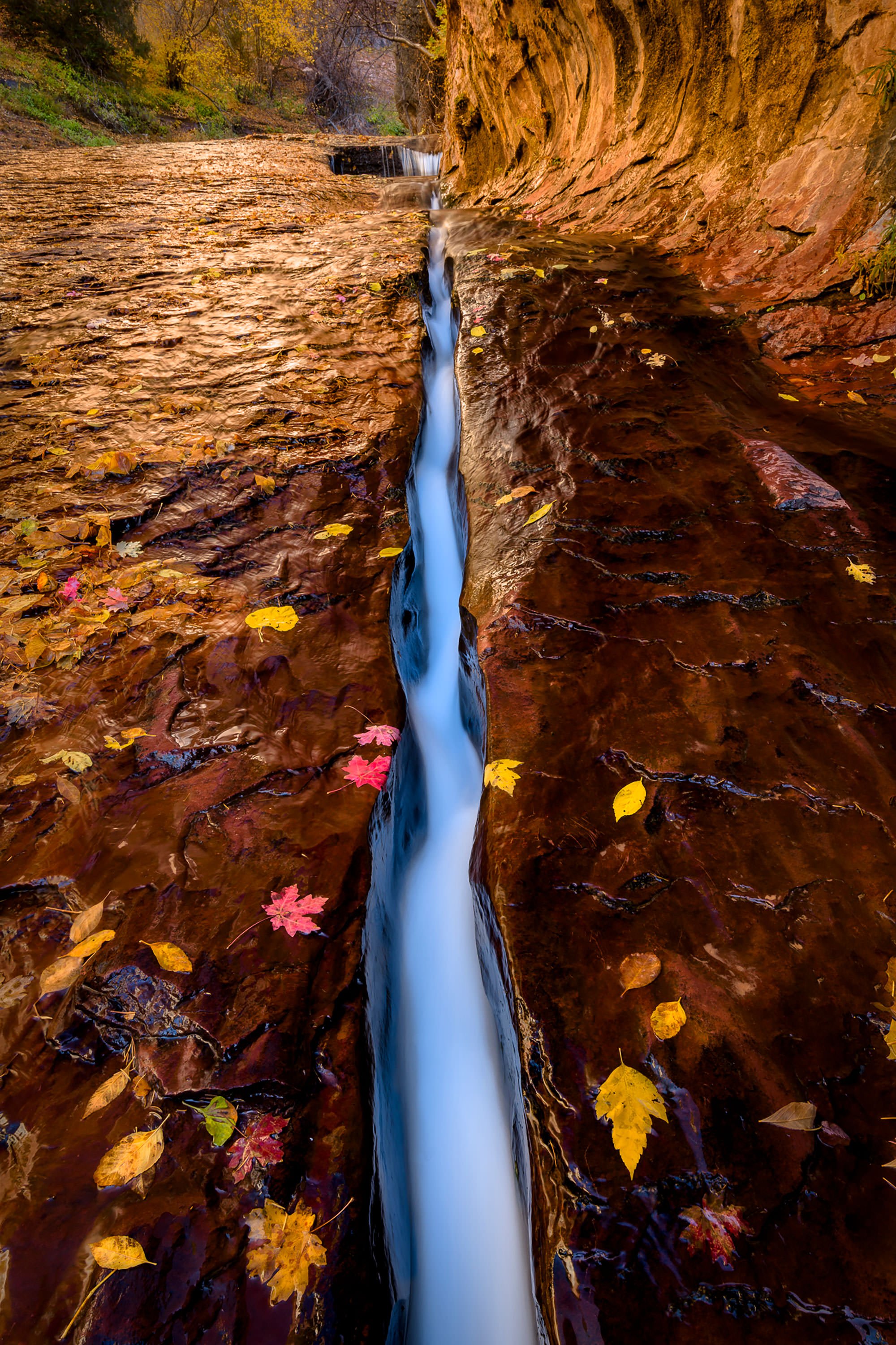
THE CRACK
Zion National Park, UT
Image by Darron Franta @ www.frantaphotography.com
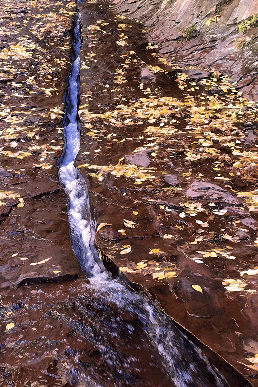
The Crack (also known as The Chute) is a simple 5-inch x 25-ft. fracture line in the red river bed, only a few hundred yards from the Subway entrance. As the water from the North Creek flows through the crack, it creates a fascinating visual contrast between the crimson rock and water.
During the fall, photographers sometimes place gold or red maple leaves next to the crack to add extra dimension. When hiking to the Subway, definitely make time to stop and photograph this simple visual work of art. This is not as easy as it looks, so make sure you read the special nuances of the shot below.
The Crack is located toward the very end of the grueling 4.5-mile hike (Left Fork North Creek - Subway) through the Kolob Terrace in Zion National Park. The hike is not for the weak or the faint of heart, but at the end you are rewarded with 3 GREAT photographic opportunities (Archangel Fall, the Crack, and the iconic Subway).
Location summary by Tim Wier
Trail Difficulty - HARD
I would rate the difficulty of this trail as a 4.5 on a scale of 1-5 (with 5 being most difficult).
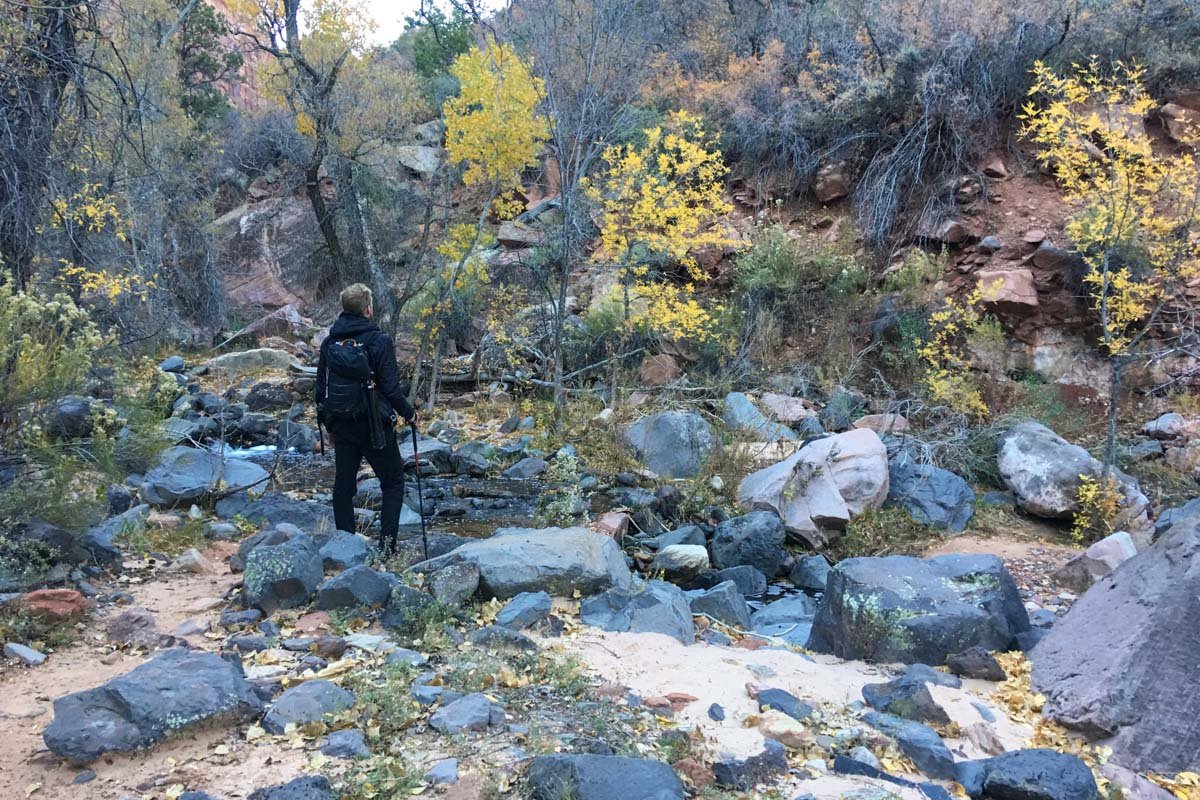
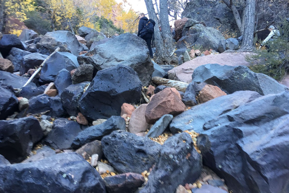
The trail to the Crack is a non-technical hike, but it is long (9 miles round trip) and stressful. The hike crosses a creek multiple times and climbs over and around MANY large rocks and boulders. The worst part(s) of the hike are toward the beginning (and the end): as you hike down (and then up on the return) a 500ft. vertical trek with many steep and rocky switchbacks to the creek below. The total roundtrip will take 6-9 hours (those who abandon the idea of keeping their feet dry early on the hike, tend do the hike in less time), so I would suggest starting the hike as close to first light as possible.
This hike is not for everyone and should not be attempted unless you are in good to great shape and have good coordination. Once you finish the hike you are exhausted, worn out, triumphant, and feel like you have achieved a mental “badge of honor.”
GPS Coordinates & Elevation
5,287ft Elevation
Google Earth
Download KMZ Trail File
Click Here to download the KMZ file for this location.
Directions
CLICK HERE to get driving directions the Left Fork North Creek (Subway) trailhead parking lot.
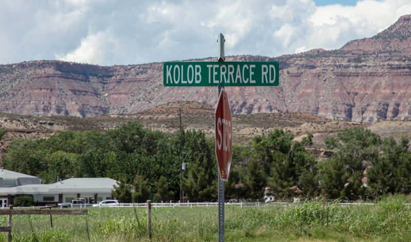
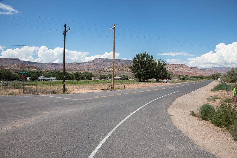
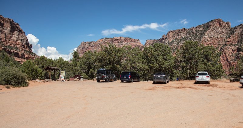
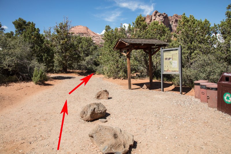
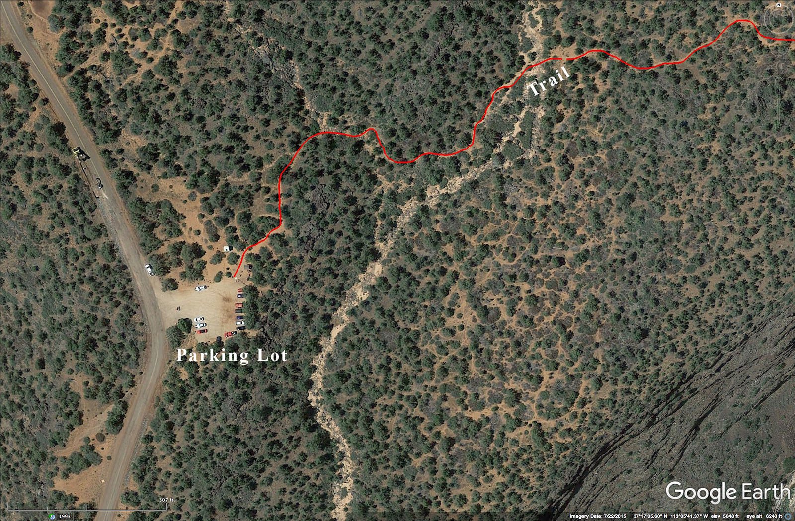
Directions from Springdale, UT: Take UT 9 west 12 miles to the little community of Virgin. Take a right (north) at Comino Del Rio for 0.9 mile, where the road turns into Kolob Terrace Rd. Continue on Kolob Terrace Rd for 8.1 miles until you get to Left Fork trailhead parking lot. The parking lot holds about 15 – 20 cars.
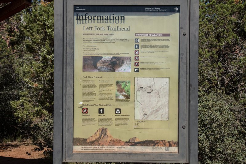
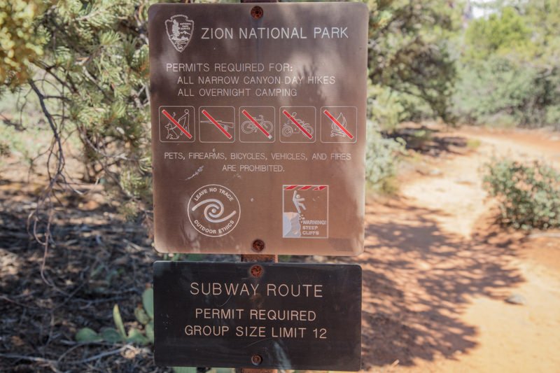
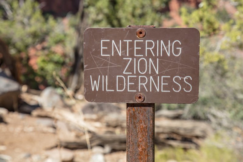
VERY IMPORTANT: Make sure you have your permit to hike the Left Fork North Creek (Subway) before starting the hike. Keep your receipt on your person and the copy taped to the windshield of your vehicle. There is a good chance you will see a park ranger along the way and the fines are VERY steep.
Once you arrive at the parking lot, the trailhead is on the left side between the restrooms and the park information board. From the trailhead, hike northeast on a fairly well marked trail for about 0.5 mile until you come to the ledge of the steep descent down into a ravine. The 0.25 mile trail down to the creek has a vertical drop of about 500 feet. This part of the hike is steep and slippery in some places, and goes through a series of switchbacks. Just take your time and be careful.
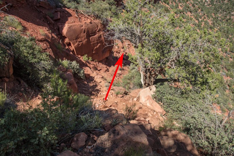
Once you get down to the creek, stop and look around to get your bearings. If you have a GPS, I would mark this spot. It is VERY IMPORTANT you remember this spot, as it will be the place you exit the ravine for the hike back to the parking lot.
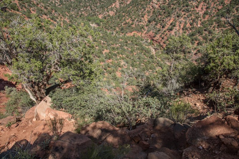
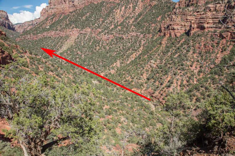
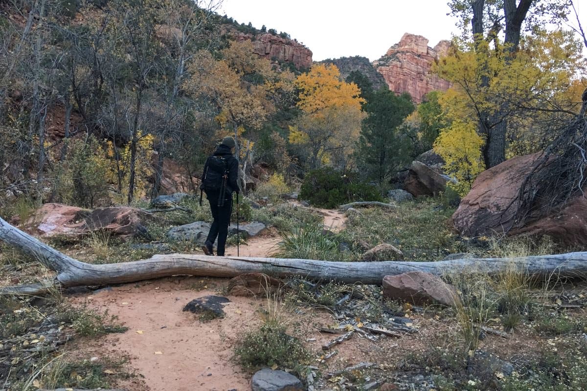
From this point the hike to The Crack is about 3.3 miles along the North creek. You will be crossing the creek several times and climbing over and around lots of rocks and boulders. Again, this is not an easy hike and should only be attempted if you are in good shape and have good balance.
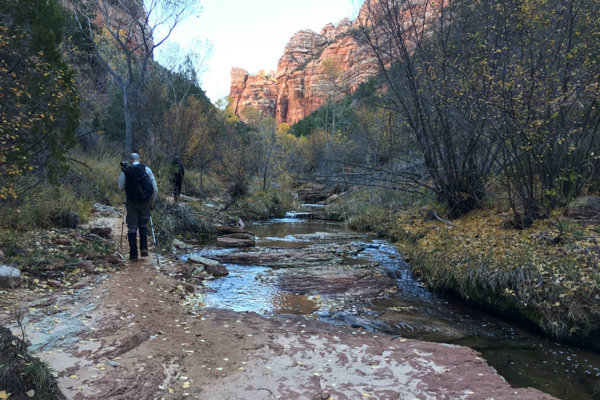
For those interested in the Archangel Falls or the Subway, they are just behind and just in front of The Crack on North Creek. Always be aware of the time and make sure you allow for 2-3 hours to return to the parking lot. Getting lost in this area after dark is not fun.
Photography Tips
This Crack is a simple fracture line in the red river bed of the North Creek just before entering the Subway. It is about 5 inches wide and 25 feet long. Most images here are shot directly above the Crack where you focus on the water flow. Seems easy, but it’s really not. Here’s why.
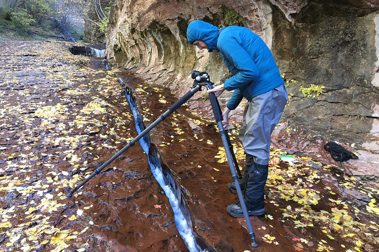
The red rock you are standing one is in a constant stream of water, with micro algae growing on the rock. Because of this, is rock is VERY, VERY, VERY slick which makes it VERY EASY to slip. If you slip and your camera falls against the red rock, it will turn a great day into a very bad day. BE VERY CAREFUL.
To capture the water flow, you need a shutter speed of at least a ½ second, which requires a tripod. The problem with using a tripod is you are shooting straight down. Unless you are high enough, one of the tripod legs will be in your shot. If you get your tripod too high, you can’t see through the viewfinder. And you’re dealing with all of this while standing on a very, very slick surface (see image below).
EXIF Data
Focal Length – 16 mm
Exposure – 1 sec @ f 8.0
ISO – 100
Date – Nov 1st
Time – 1:15 pm
Best Time of Day to Shoot
The best time to shoot the Crack is noon or later, as the sun is blocked and the glare off of the water is reduced. If you are going to shoot both the Subway and the Crack, I would suggest shooting the Subway first.
Best Time of Year
This location is great for photography any time of year as long as the water flow is not too light or too heavy. My favorite time to shoot is fall, because while you are on the Subway hike you can find a nice red or yellow maple leaf to place next to the Crack to give it depth.
Lens(es) Needed
You can use focal lengths between 24-50mm, as long as the lens can focus close (not necessarily a macro). If you shoot directly above the Crack, you will be focusing from between 1 and 2 feet above the rock surface. When hiking the Subway, you want to pack only the minimal amount of equipment. For all 3 shots: Subway, Archangel Falls and the Crack - you can get away with a single 16-35mm lens.
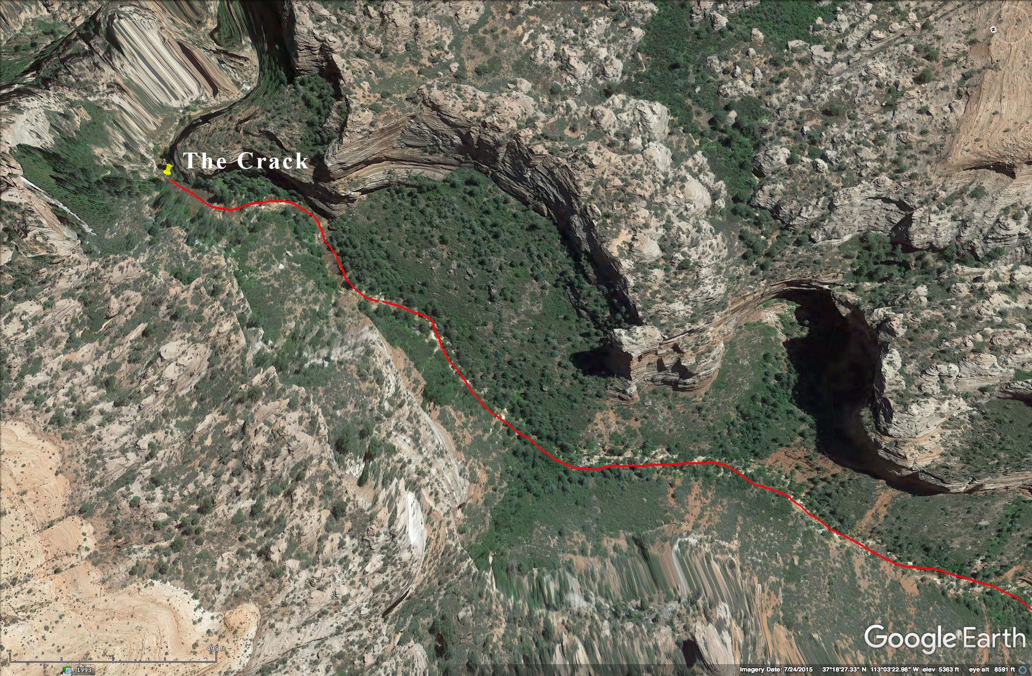
Birds-Eye View From Google Earth Pro
Permits
Due to the popularity of the Subway, a special national parks service permit is required to enter and hike the Left Fork North Creek (SUBWAY). A limit of 80 permits are available each day. The registration for a permit is available by advanced lottery, registration, or walkup. In the peak season, the advanced lottery is a must to reserve your spot. Cost for reservation is $5 and the permit is another $15. Here is the link to the NPS Wilderness Reservation System choose the Left Fork North Creek (Subway) and follow the instructions to obtain a reservation.
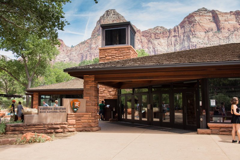
VERY IMPORTANT: your reservation is not a permit. It just reserves your spot to get a permit. Obtaining a permit is a two-step process: 1) reserving a permit and 2) paying for and picking up the permit at the Zion National Park Visitor Center (9am - 5pm). It is imperative to pick up your permit the day before your hike.
If you are coming from the north (via Salt Lake City), a permit can also be obtained at the Kolob Visitor Center (9am - 4:30pm).
Do not attempt to hike the trail without a permit as the fines are severe.
Direction of the Shot
The direction of your shot is north by northeast @ 60°.
Equipment Needed
You will need a tripod, a polarizer, and potentially a neutral density filter to reduce your shutter speed to ½ second or longer to create the silky water flow. I would also suggest bringing a tripod with a horizontal extension.
Other items you may consider are waders / wet shoes and a walking stick (trek poles), as you will be walking/crossing the North Creek many times. You might also consider bringing a small broom to sweep away the sand that sometimes settles on the lower steps.
For the hiking equipment (dry suit/wet pants, neoprene shocks, wet shoes, and walking stick), there are several good outfitters in Springdale, UT, that rent by the day/week.
Zion Adventure Company
(435) 772-1001
36 Lion Blvd, Springdale, UT
Zion Outfitter
(435) 772-5090
7 Zion Park Blvd, Springdale, UT
Zion Guru
435-632-0432
792 Zion – Mount Carmel Hwy, Springdale, UT
Number of Other Photographers to Expect
More than half of the hikers each day are photographers. The shooting area around the Crack is fairly small (only about 20ft. long) and only holds about 2-3 photographers at a time. As mentioned, the surface you will be standing on is very, very slick, so just take your time and be patient.
Weather
Zion is known for a wide range of weather conditions. Temperatures in the summer can exceed 100° and get below freezing in winter. Temperatures vary with changes in elevation and the day/night temperatures may differ by up to 30°. The most important thing to be aware of is the possibility of flash floods. They come quick and can be deadly.
Cell Service
I have Verizon and I had cell service until I reached the Subway Hike parking lot. Cell service on the walk is hit and miss, and unreliable.
Overnight Camping Options
Springdale is a GREAT little town at the south entrance to Zion National Park. It has an abundance of nice lodging and outstanding eating establishments.
Two nice campgrounds are inside the south entry to the park (just north of Springdale): the South Campground and the Watchman Campground. The South Campgrounds have 117 campsites on a first-come basis. The Watchman Campground has 175 campsites and can be reserved up to six months prior to your arrival date online at www.recreation.gov or by calling 877-444-6777. Reservations are strongly suggested: The campground is full every night during the reservation season.
There is also an excellent RV Park called Zion River Resort, with campgrounds and cabins in Virgin, UT, just by the Kolob Terrace Road turnoff of UT-9 to get to the Left Fork Trailhead. It’s a very nice place with a grill and self-service, coin-operated laundry mat.
Nearby camping and lodging
Camping - click on the campground below for directions
South campground – just inside the park Springfield
Watchman campground – just inside the park Springfield
Zion River Resort – 20 miles in Virgin
Lodging - click on the lodging below for a TripAdvisor review
Desert Pearl Inn
(435) 772-8888
707 Zion – Mount Carmel Hwy, Springdale, UT
Cable Mountain Lodge
(435) 772-3366
147 Zion – Mount Carmel Hwy, Springdale, UT
Hampton Inn & Suites Springdale
(435) 627-9191
1127 Zion – Mount Carmel Hwy, Springdale, UT
Nearby Restaurants
Springdale has many excellent restaurants and brewpubs. I have my favorites for breakfast, lunch, and dinner. For breakfast, I split time between Oscar's Café and Meme's Café. For lunch, Oscar's Café and Cafe Soleil are always good. For dinner, the Spotted Dog Café and King’s Landing Bistro are good choices. Again, there is no shortage of good dining in Springdale.
Nearby Restaurants - click on the restaurant below for yelp review
The Spotted Dog
(435) 772-0700
428 Zion – Mount Carmel Hwy, Springdale, UT
Oscar's Cafe
(435) 772-3232
948 Zion – Mount Carmel Hwy, Springdale, UT
Cafe Soleil
(435) 772-0505
205 Zion – Mount Carmel Hwy, Hurricane, UT
Area Guides and Workshops
None
Other Resources
Here is a link to a great recourse for all things Zion National Park (Joe Braun’s Zion National Park visitor’s website). It is packed with excellent material for the Subway hike and many other features in the park. This link takes you to Joe's detailed description of the Subway trail - Joe's Guide to Zion National Park (The Subway from the bottom).
As mentioned, the Subway hike (to Archangel Falls, the Crack and the Subway) is long - 9 miles roundtrip - and strenuous. Here is a link to a good article for beginning hikers by Jenny Hobby. It is very much worth reading. The Ultimate Beginner’s Guide to Hiking
Here are other great reference sites - Zion Canyon.com and Springdale, UT