
The Subway
THE SUBWAY
Zion National Park, UT
Image by Darron Franta @ www.frantaphotography.com
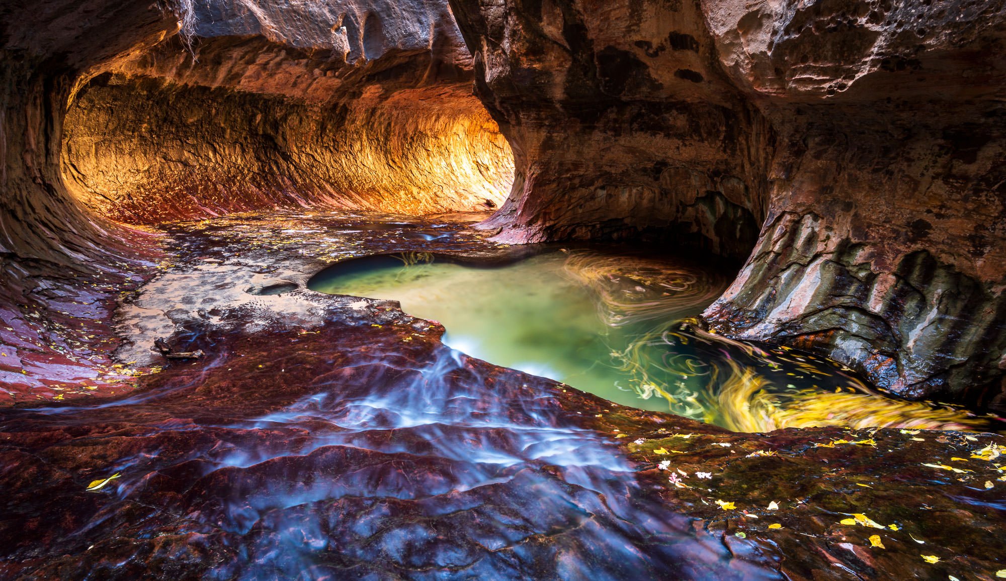
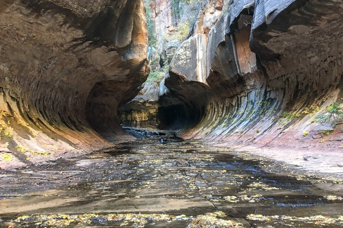
The Subway is one of the most intriguing places you will ever visit and is one of the photographic gems of the American Southwest. It is located at the end of the grueling 4.5-mile hike, but when you finally arrive at the tube-like slot canyon, you find yourself completely mesmerized.
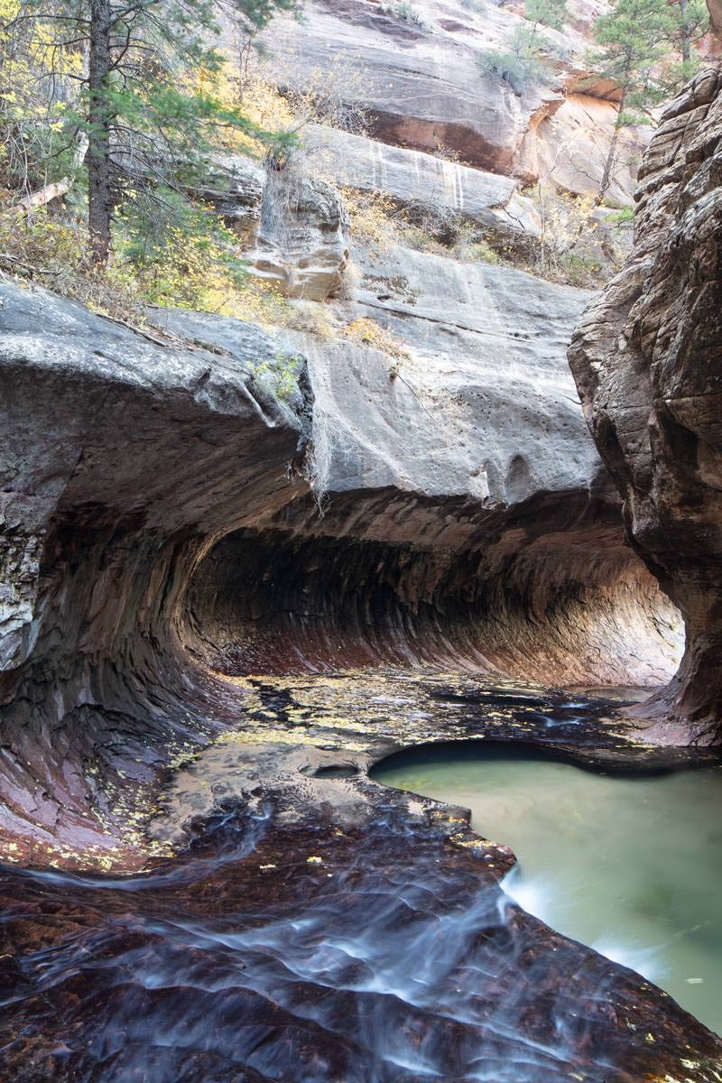
This place is simply amazing, and the turquoise pools and the glow on the florescent red walls are absolutely spectacular. For many, this is their favorite hike in the entire southwest.
Image by Darron Franta and location summary by Tim Wier
Trail Difficulty - HARD
I would rate the difficulty of this trail as a 4.5 on a scale of 1-5 (with 5 being most difficult).
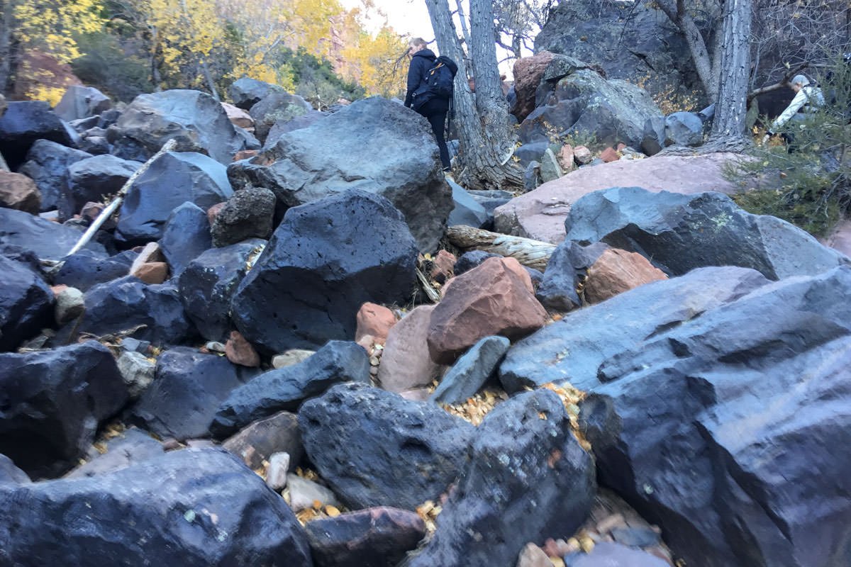
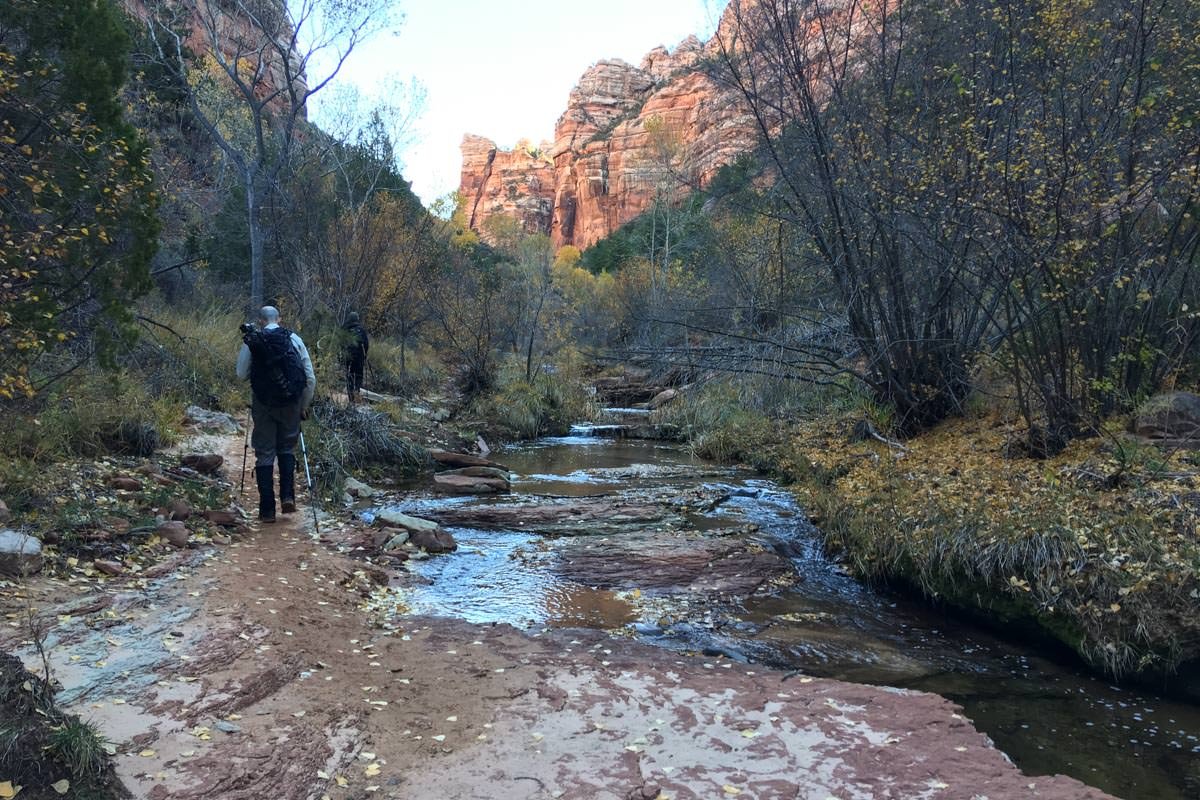
The trail to the Subway is a non-technical hike, but it is long (9 miles round trip) and stressful. The hike crosses a creek multiple times and climbs over and around MANY large rocks and boulders. The worst part(s) of the hike are toward the beginning (and the end): as you hike down (and then up on the return) a 500ft. vertical trek with many steep and rocky switchbacks to the creek below. The total roundtrip will take 6-9 hours (those who abandon the idea of keeping their feet dry early on the hike, tend do the hike in less time), so I would suggest starting the hike as close to first light as possible.
This hike is not for everyone and should not be attempted unless you are in good to great shape and have good coordination. Once you finish the hike you are exhausted, worn out, triumphant, and feel like you have achieved a mental “badge of honor.”
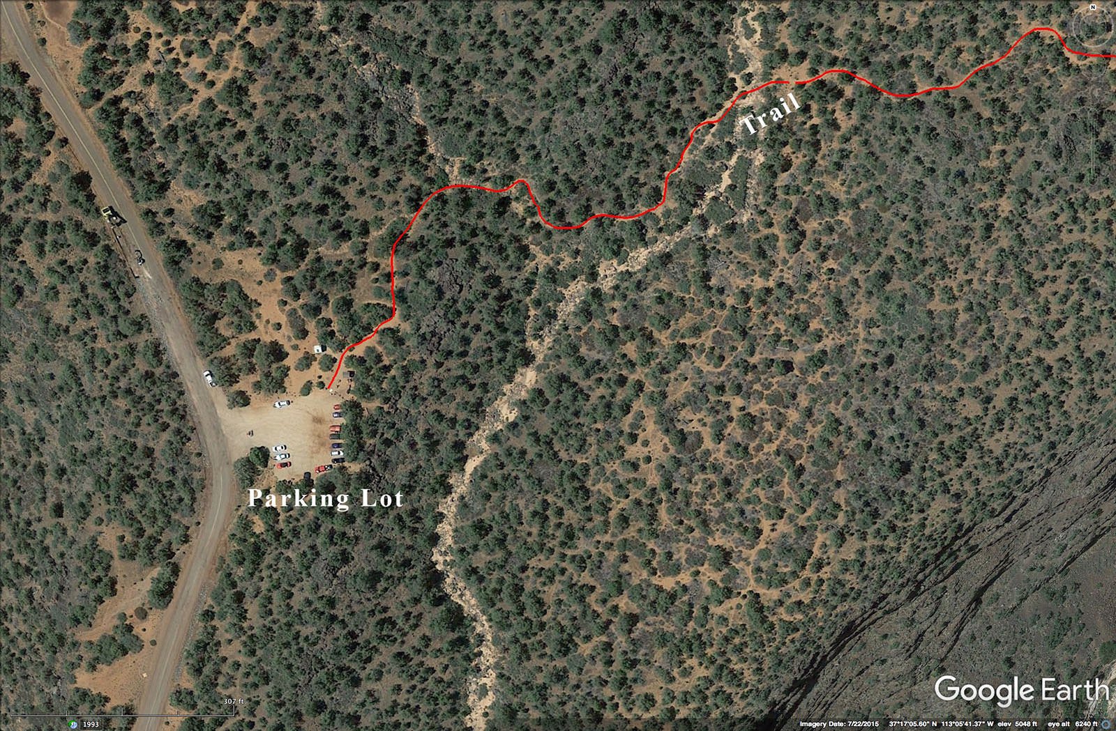
GPS Coordinates & Elevation
5,357ft Elevation
Google Earth
Download KMZ Trail File
Click Here to download the KMZ file for this location.
Directions
CLICK HERE to get driving directions the Left Fork North Creek (Subway) trailhead parking lot.
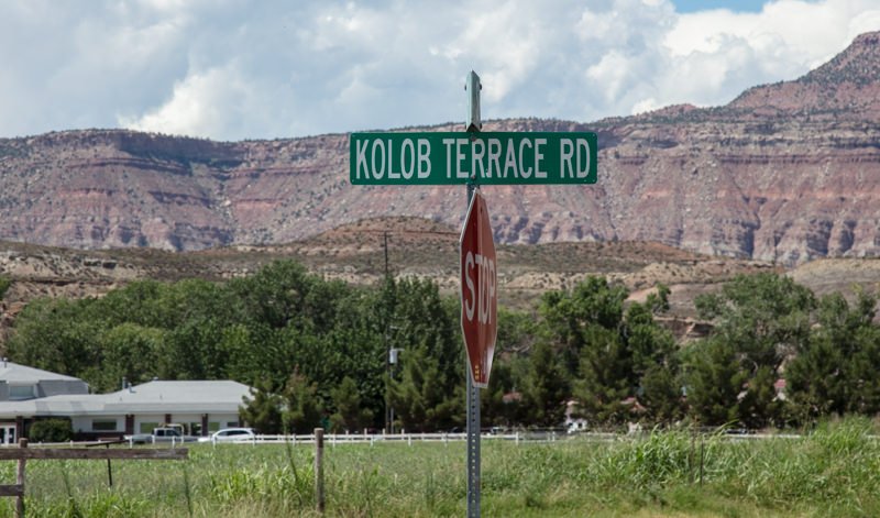
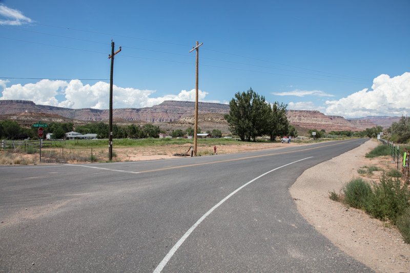
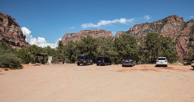
Directions from Springdale, UT: Take UT 9 west 12 miles to the little community of Virgin. Take a right (north) at Comino Del Rio for 0.9 mile, where the road turns into Kolob Terrace Rd. Continue on Kolob Terrace Rd for 8.1 miles until you get to Left Fork trailhead parking lot. The parking lot holds about 15 – 20 cars.
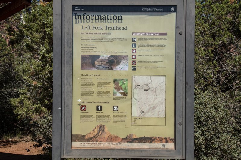
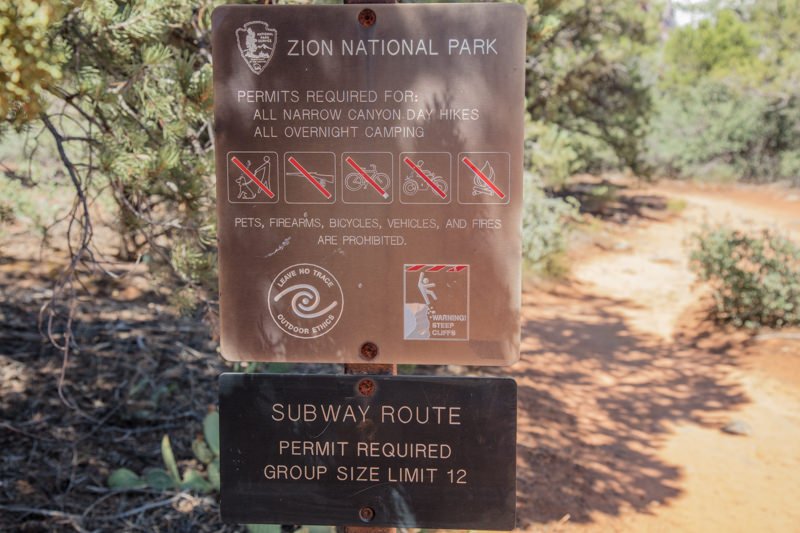
VERY IMPORTANT: Make sure you have your permit to hike the Left Fork North Creek (Subway) before starting the hike. Keep your receipt on your person and the copy taped to the windshield of your vehicle. There is a good chance you will see a park ranger along the way and the fines are VERY steep.
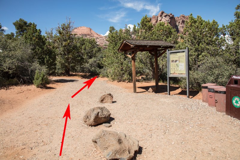
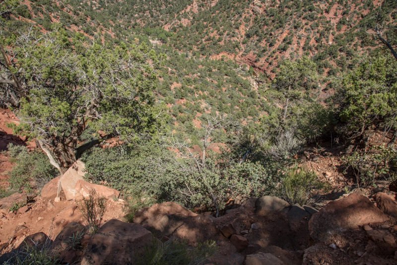
Once you arrive at the parking lot, the trailhead is on the left side between the restrooms and the park information board. From the trailhead, hike northeast on a fairly well marked trail for about 0.5 mile until you come to the ledge of the steep descent down into a ravine. The 0.25 mile trail down to the creek has a vertical drop of about 500 feet. This part of the hike is steep and slippery in some places, and goes through a series of switchbacks. Just take your time and be careful.
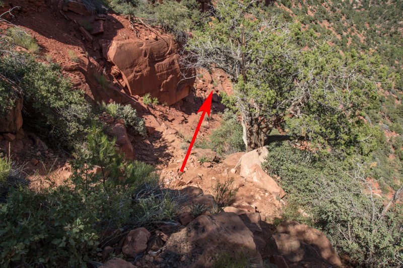

Once you get down to the creek, stop and look around to get your bearings. If you have a GPS, I would mark this spot. It is VERY IMPORTANT you remember this spot, as it will be the place you exit the ravine for the hike back to the parking lot.
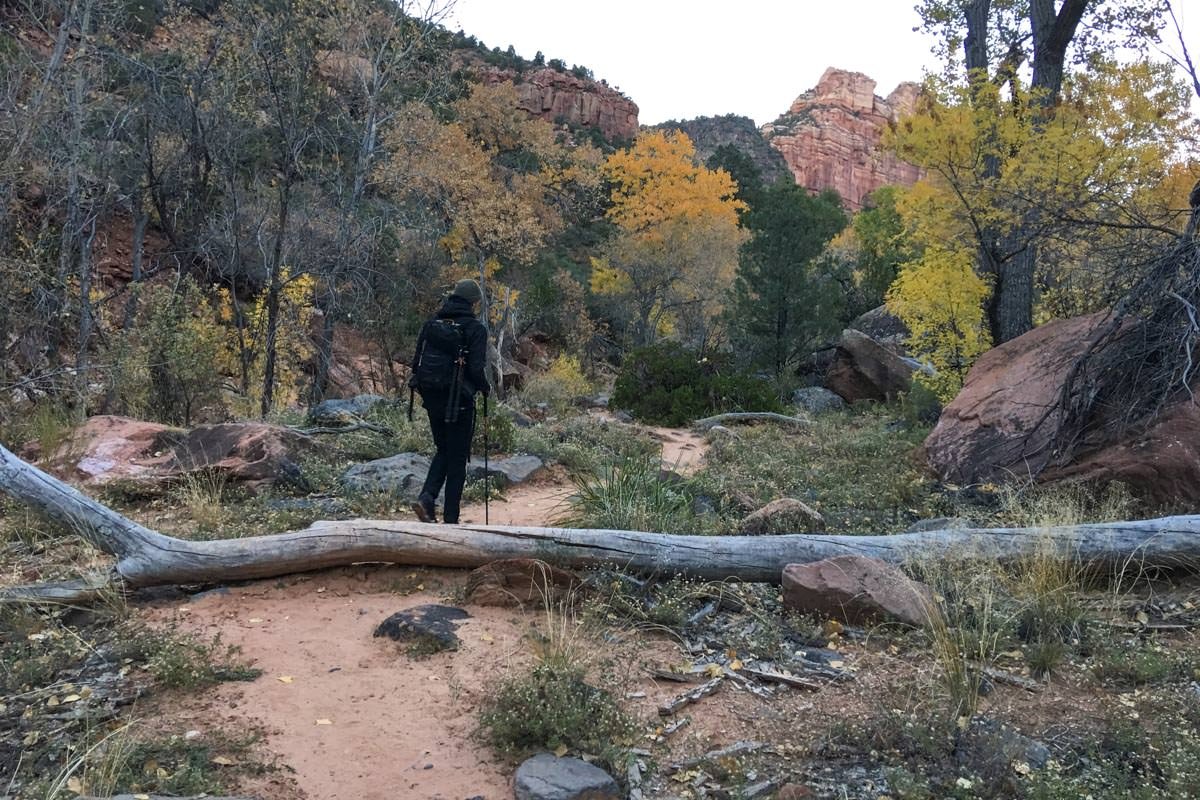
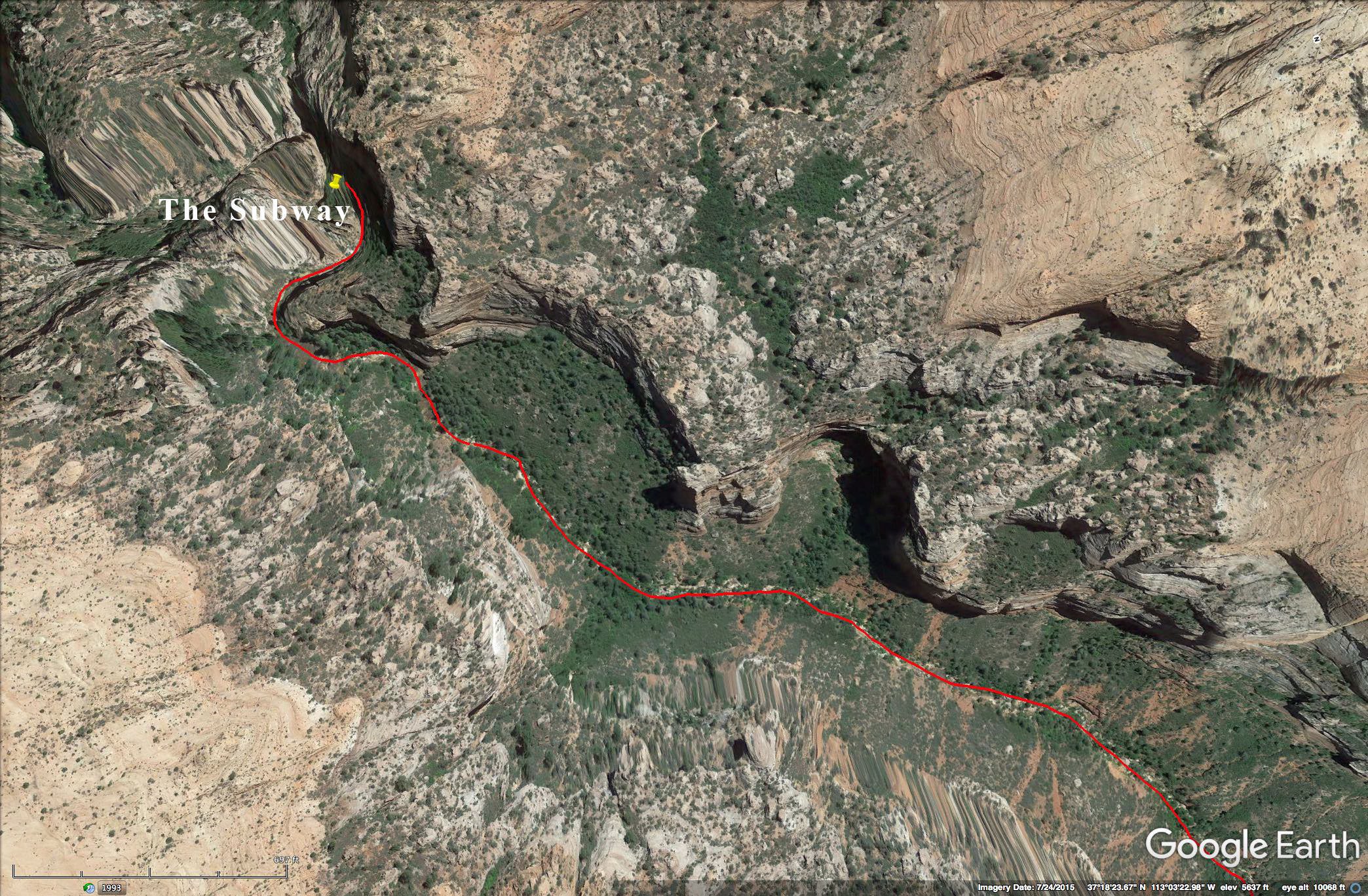
From this point the hike to The Subway is about 3.5 miles along the North creek. You will be crossing the creek several times and climbing over and around lots of rocks and boulders. Again, this is not an easy hike and should only be attempted if you are in good shape and have good balance.
For those interested in the Archangel Falls or the Crack, these locations are found before you get to the Subway. Always be aware of the time and make sure you allow for 2-3 hours to return to the parking lot. Getting lost in this area after dark is not fun.
If you are interested in shooting THE CRACK, it is usually best to shoot it after you have photographed the Subway (as it is better after noon).
Photography Tips
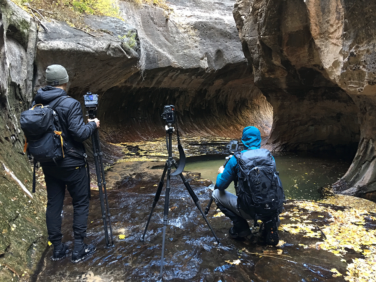
The primary location that most people shoot from is relativity small and extremely slick. You will be standing directly next to 2 separate large pools of water about 6ft. deep. One mistake and your camera gear is doomed. Additionally, the room is not in direct sun so the shutter speeds are usually longer than a second.
While you are waiting your turn (behind the area of the photographers shown below), collect your thoughts around the composition, which lens(es) you will use, and other equipment you will need, as time in The Subway is precious and others will be waiting their turn.
Another special nuance of the shot is the room usually has water running through it (1/2” or so deep) and there is no dry space to set your camera bag to change lenses.
EXIF Data
Focal Length – 16 mm
Exposure – 8 sec @ f 8.0
ISO – 100
Date – Oct 31st
Time – 12:15 pm
Best Time of Day to Shoot
The best time to shoot The Subway is early to late morning, as the sun’s rays illuminate the entrance of the tube. Even if you cannot make it when the tube is illuminated, it is still a great shot. As mentioned, always be aware of the time and make sure you allow for 2-3 hours to return to the parking lot.
Best Time of Year
This location is great for photography any time of year.
Lens(es) Needed
The shot above was taken with a 24mm lens. The room The Subway is in is fairly small, so you may want to use a wider lens or shoot a multi-shot panorama. When hiking the Subway, you want to pack only the minimal amount of equipment. For all 3 shots: Subway, Archangel Falls and the Crack - you can get away with a single 16-35mm lens.
Birds-Eye View From Google Earth Pro
Permits
Due to the popularity of the Subway, a special national parks service permit is required to enter and hike the Left Fork North Creek (SUBWAY). A limit of 80 permits are available each day. The registration for a permit is available by advanced lottery, registration, or walkup. In the peak season, the advanced lottery is a must to reserve your spot. Cost for reservation is $5 and the permit is another $15. Here is the link to the NPS Wilderness Reservation System choose the Left Fork North Creek (Subway) and follow the instructions to obtain a reservation.
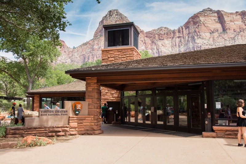
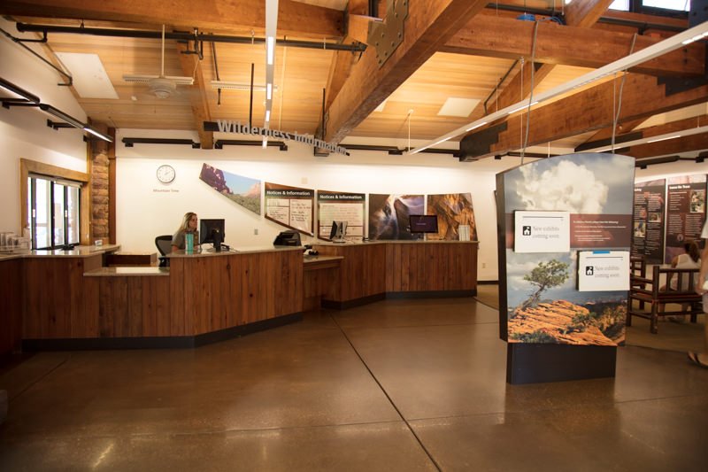
VERY IMPORTANT: your reservation is not a permit. It just reserves your spot to get a permit. Obtaining a permit is a two-step process: 1) reserving a permit and 2) paying for and picking up the permit at the Zion National Park Visitor Center (9am - 5pm). It is imperative to pick up your permit the day before your hike.
If you are coming from the north (via Salt Lake City), a permit can also be obtained at the Kolob Visitor Center (9am - 4:30pm).
Do not attempt to hike the trail without a permit as the fines are severe.
Direction of the Shot
You are in a slot canyon, thus the direction of your shot is not important..
Equipment Needed
You will need a tripod, a polarizer and potentially a neutral density filter to reduce your shutter speed to ½ second or longer to create the silky water flow.
Other items you may consider are waders / wet shoes and a walking stick (trek poles), as you will be walking/crossing the North Creek many times. You might also consider bringing a small broom to sweep away the sand that sometimes settles on the lower steps.
For the hiking equipment (dry suit/wet pants, neoprene socks, wet shoes, and walking stick), there are several good outfitters in Springdale, UT, that rent by the day/week.
Zion Adventure Company
(435) 772-1001
36 Lion Blvd, Springdale, UT
Zion Outfitter
(435) 772-5090
7 Zion Park Blvd, Springdale, UT
Zion Guru
435-632-0432
792 Zion – Mount Carmel Hwy, Springdale, UT
Number of Other Photographers to Expect
Roughy half of the hikers each day are photographers, and most are looking to shoot the Subway. The PRIME location for the classic shot can only accommodate 1 or 2 photographers at a time. However, subway chamber (the area behind the PRIME location) can hold a few more folks.
I have been there when as many as 7-10 photographers are lined up for their opportunity. Patience is very important.
Weather
Zion is known for a wide range of weather conditions. In the summer, temperatures can exceed 100° and dip below freezing in the winter. Temperatures vary with changes in elevation and day/night temperatures may differ by up to 40°.The most important thing to be aware of is the possibility of flash floods. They come quick and can be deadly.
Cell Service
I have Verizon and I had cell service until I reached the Subway Hike parking lot. Cell service on the walk is hit and miss, and unreliable.
Overnight Camping Options
Springdale is a GREAT little town at the south entrance to Zion National Park. It has an abundance of nice lodging and camping options.
There are two NPS campgrounds inside Zion (just north of Springdale): the South Campground and the Watchman Campground. The South Campgrounds have 117 campsites on a first-come basis. The Watchman Campground has 175 campsites and can be reserved up to six months prior to your arrival date online at www.recreation.gov or by calling 877-444-6777. Reservations are strongly suggested. The campground is usually full every night during the busy season.
Nearby camping and lodging
Camping - click on the campground below for directions
South campground – just inside the park Springfield
Watchman campground – just inside the park Springfield
Zion River Resort – 20 miles in Virgin
Lodging - click on the lodging below for a TripAdvisor review
Desert Pearl Inn
(435) 772-8888
707 Zion – Mount Carmel Hwy, Springdale, UT
Cable Mountain Lodge
(435) 772-3366
147 Zion – Mount Carmel Hwy, Springdale, UT
Hampton Inn & Suites Springdale
(435) 627-9191
1127 Zion – Mount Carmel Hwy, Springdale, UT
Nearby Restaurants
Springdale has many excellent restaurants and brewpubs. I have my favorites for breakfast, lunch, and dinner. For breakfast, I split time between Oscar's Café and Meme's Café. For lunch, Oscar's Café and Cafe Soleil are always good. For dinner, the Spotted Dog Café and King’s Landing Bistro are good choices. Again, there is no shortage of good dining in Springdale.
Nearby Restaurants - click on the restaurant below for yelp review
The Spotted Dog
(435) 772-0700
428 Zion – Mount Carmel Hwy, Springdale, UT
Oscar's Cafe
(435) 772-3232
948 Zion – Mount Carmel Hwy, Springdale, UT
Cafe Soleil
(435) 772-0505
205 Zion – Mount Carmel Hwy, Hurricane, UT
Area Guides and Workshops
None
Other Resources
Here is a link to a great recourse for all things Zion National Park (Joe Braun’s Zion National Park visitor’s website). It is packed with excellent material for the Subway hike and many other features in the park. This link takes you to Joe's detailed description of the Subway trail - Joe's Guide to Zion National Park (The Subway from the bottom).
As mentioned, the Subway hike (to Archangel Falls, the Crack and the Subway) is long - 9 miles roundtrip - and strenuous. Here is a link to a good article for beginning hikers by Jenny Hobby. It is very much worth reading. The Ultimate Beginner’s Guide to Hiking
Here are other great reference sites - Zion Canyon.com and Springdale, UT