
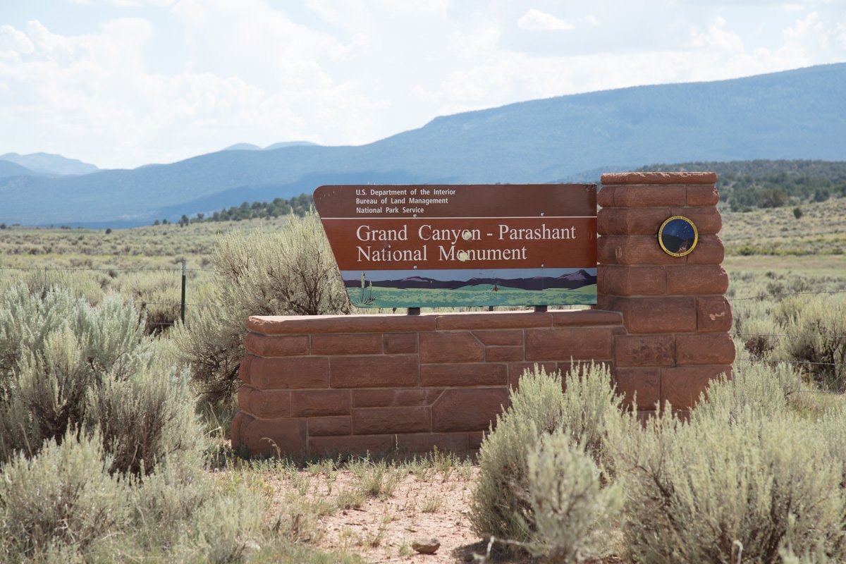
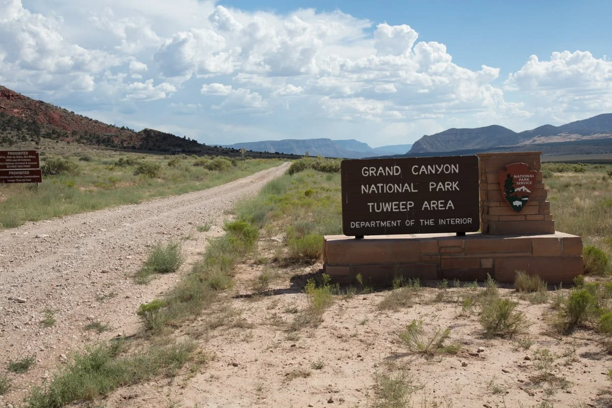
Toroweap

TOROWEAP
North Rim of Grand Canyon, AZ
Toroweap (or Tuweep as the NPS now calls it) is one of the most amazing places you will ever stand!
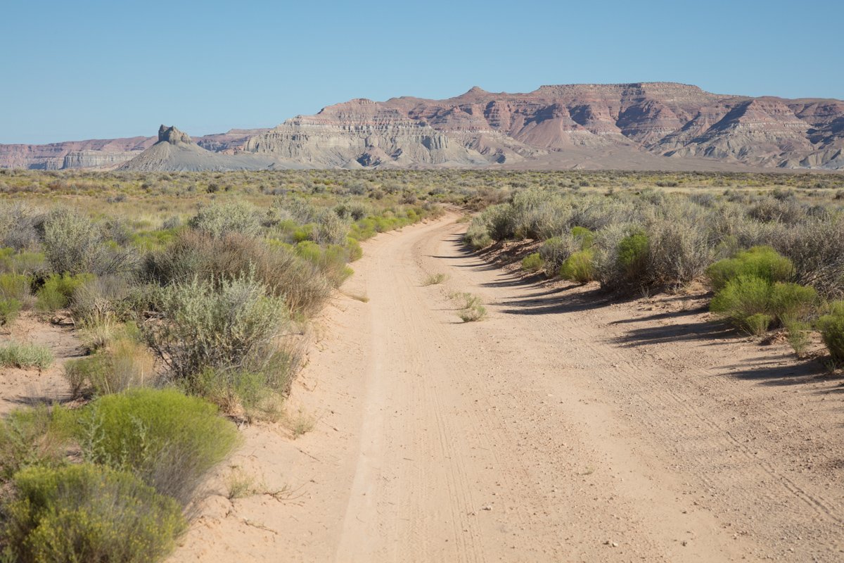
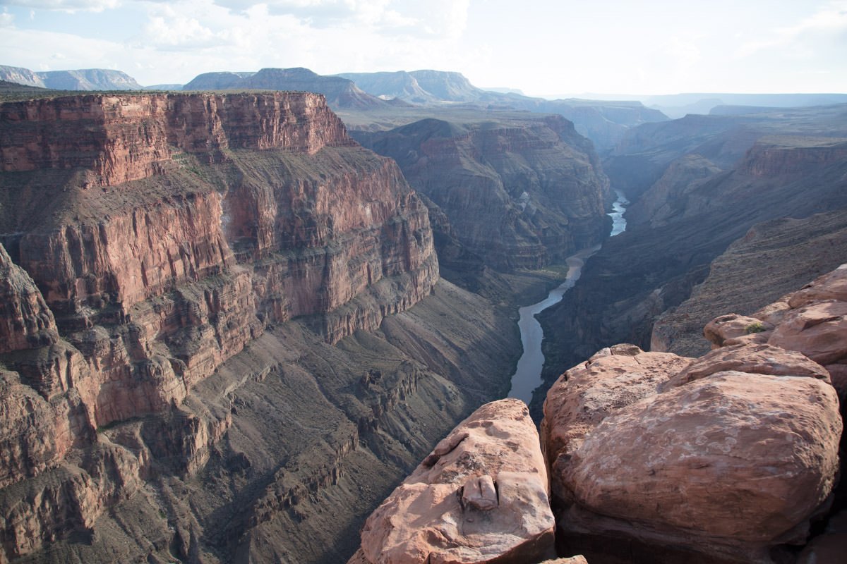
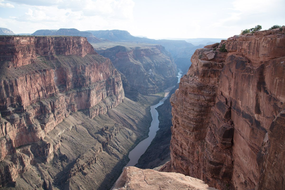
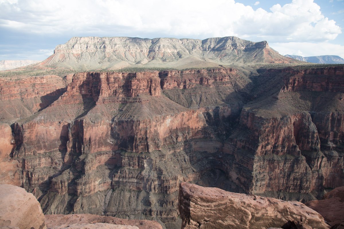
There is an 8-mile section on the north rim of the Grand Canyon where the Colorado River cuts a fairly straight path (with no major curves or turns), allowing you to have an unobstructed view of the Colorado River and inner canyon in all its glory. The Toroweap Overlook is in the middle of this section. This provides you with a stunning bird’s-eye views (both east and west) 3,000 feet above the floor of the canyon. This extremely remote spot, which is 61 miles from nowhere, offers one (actually 2) of the most magnificent views of the Grand Canyon possible, which makes it a photographer’s dream.
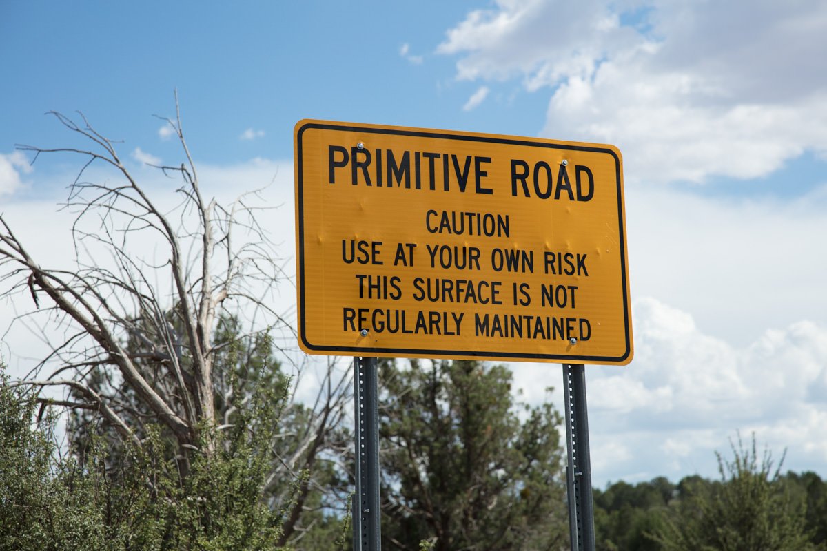
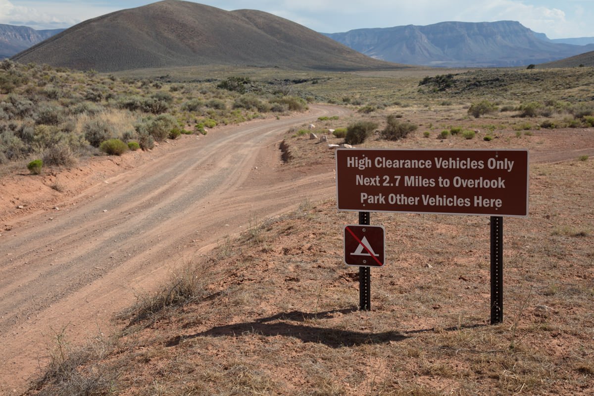
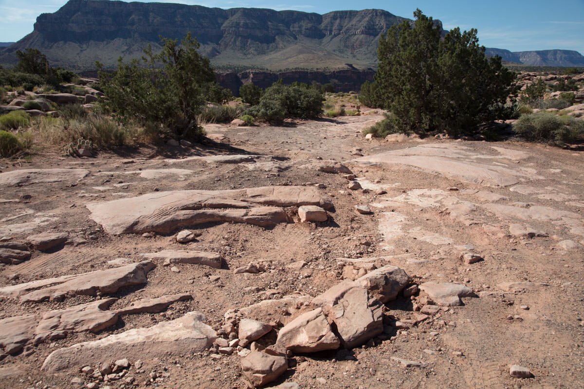
Like most great things, this shot is not easy to come by. The Toroweap Overlook is one of the most remote places in the lower 48 states and the 120 mile round trip takes between 2 ½ to 3 hours each way. The first 55 miles of gravel road is filled with bumps, holes, and washboards, and is notorious for flats (I got a flat tire the first two times I went). The last 3-5 miles of the road are treacherous with boulders, deep holes, cutting rocks, and very difficult turns. I would strongly suggest a high clearance 4-wheel drive vehicle for this trip.
But if/when you finally arrive and stand on the ledge overlooking the Grand Canyon, it is simply breathtaking.
Images and location summary by Tim Wier
This and other great locations along the North Rim of the Grand Canyon are found the Rob Strain’s comprehensive Every Photographer’s Guide.
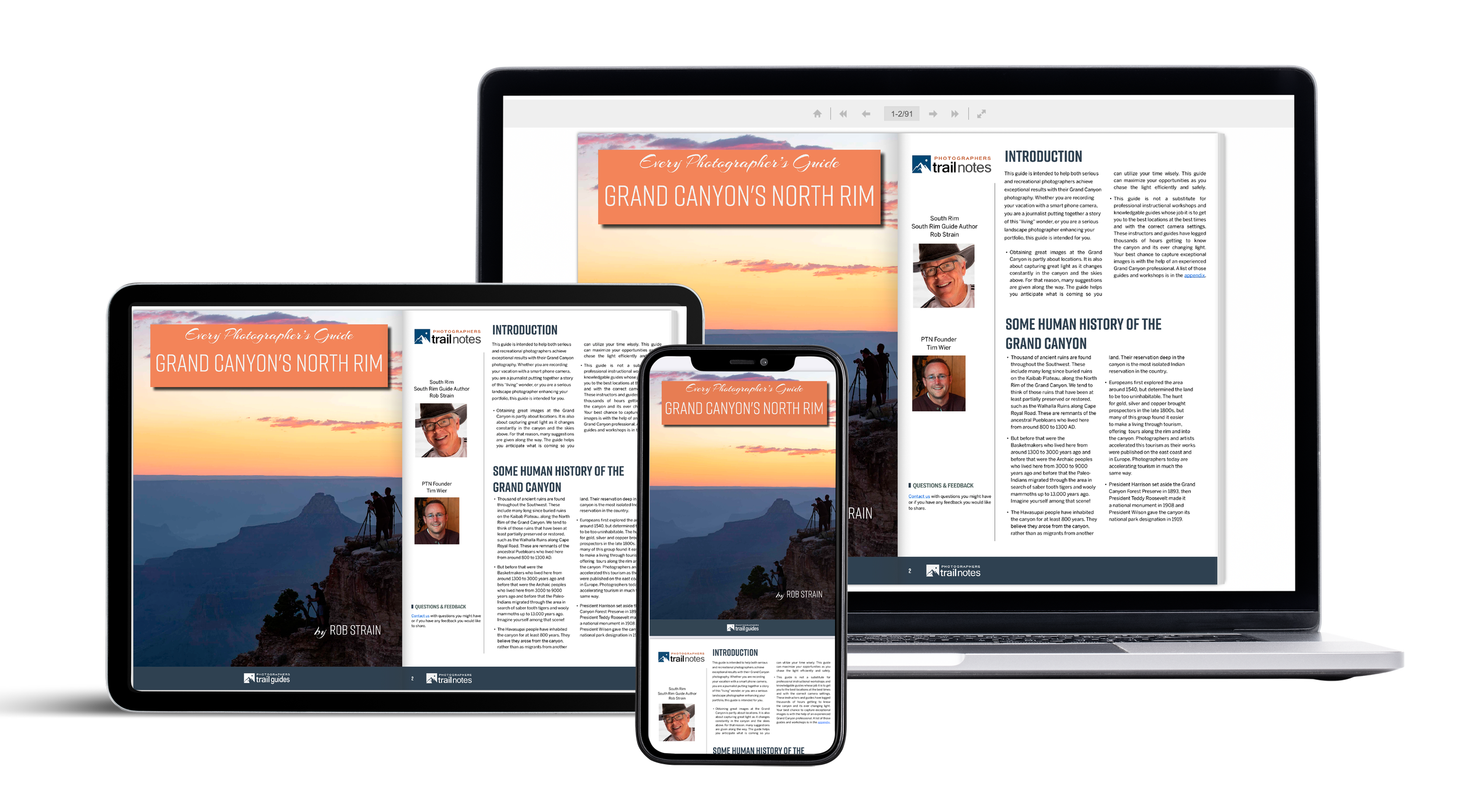
GRAND CANYON’S NORTH RIM
This 90-page guidebook leads you to multiple shooting locations at the three most common viewpoints and many less frequented locations at the North Rim of the Grand Canyon.
Unlock GPS coordinates, shooting recommendations, tips, and weather guidance. Get results by using this guide before and during your photography trip. Find eateries, lodging, hiking trails, travel considerations, and insights for a rewarding outing.
Trail Difficulty - EXTREME
I would rate the difficulty of this trail as a 5 on a scale of 1-5 (with 5 being most difficult). The walk from the parking area to The Toroweap Overlook is an easy 100 yds., but the 60 mile drive there is extreme and very taxing on you, your vehicle, and especially your tires.


GPS Coordinates & Elevation
4,631ft Elevation
Google Earth
Download KMZ Trail File
Click Here to download the KMZ file for this location.
Directions
CLICK HERE to get driving directions to the Toroweap Overlook.
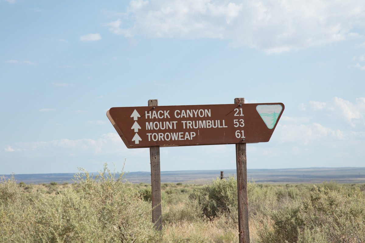
Keep in mind you will lose cell service as soon as you exit the highway and travel down the gravel road to Toroweep. The closest town is Kanab, UT.
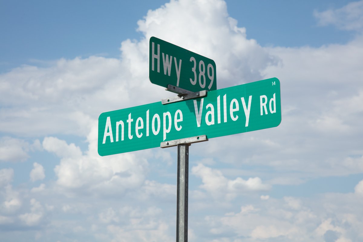
From Kanab, UT: Drive south on US-89 for 7 miles to the little community of Fredonia. Turn right (west on) AZ-389 and travel 8.3 miles until you see a National Parks sign for Toroweap (60 miles). Take a left on this dirt road (Mt Trumbull Rd.) for 60 miles.
Photography Tips
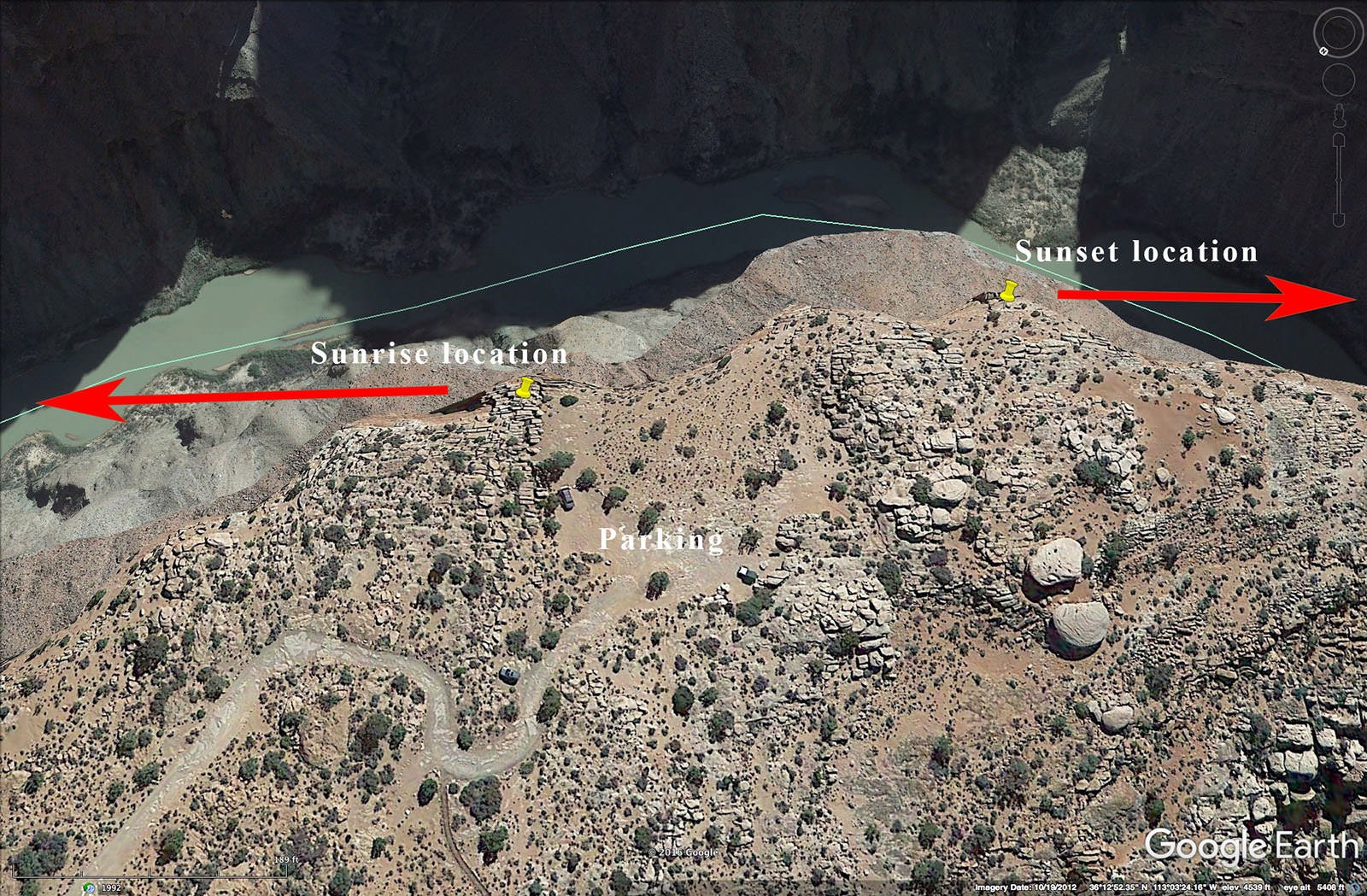
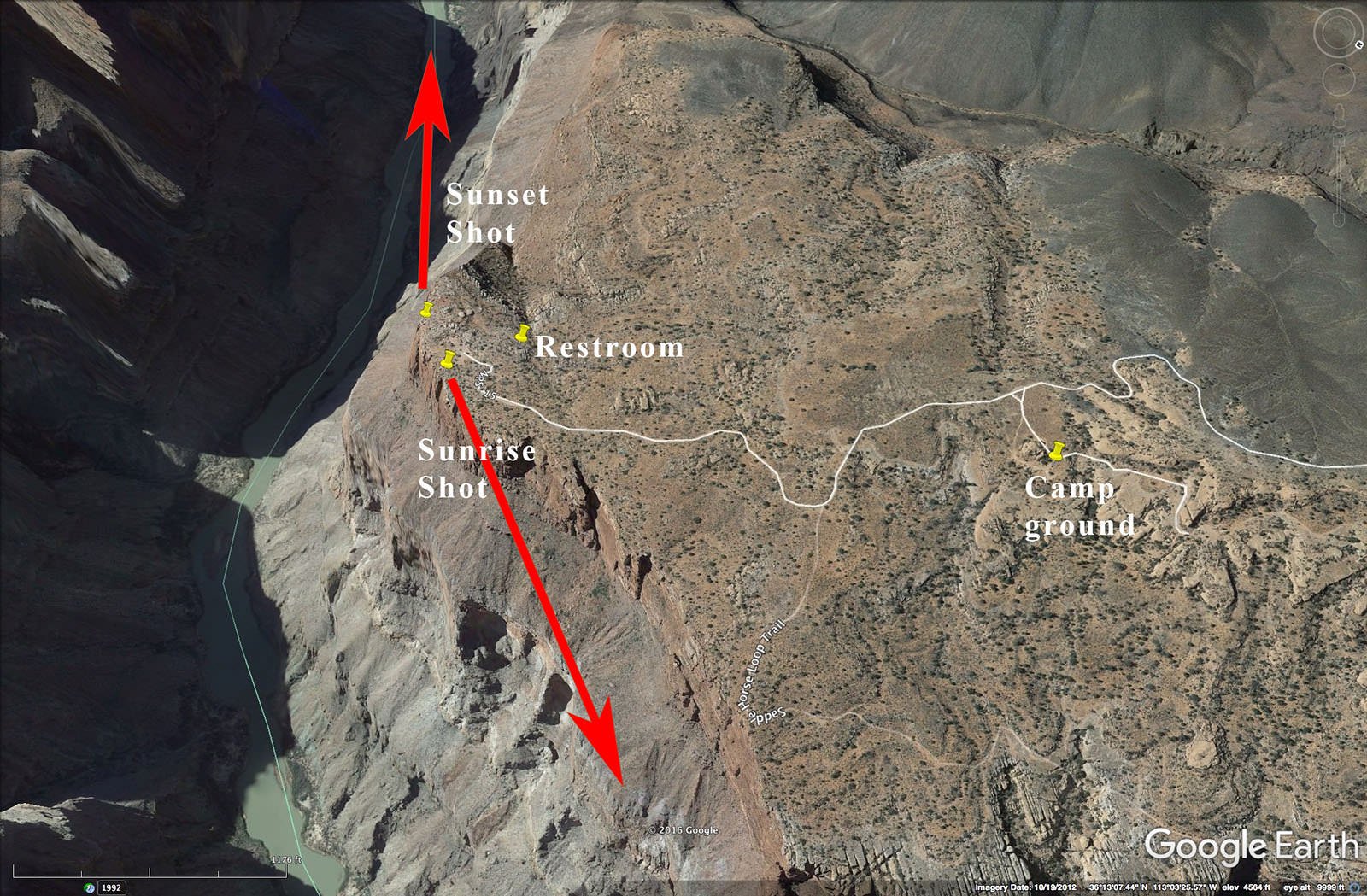
Again, there are two shots at Toroweap: sunset and sunrise.
Sunset – It is almost impossible to get a great shot without clouds! The place to get the best view of the Grand Canyon and Colorado River is on the rock ledge overlooking the canyon. The ledge you will be standing on is just a few feet from certain death, as there are no guardrails or protection of any kind. Caution is of the upmost importance. If you are afraid of heights, this is not the place for you.
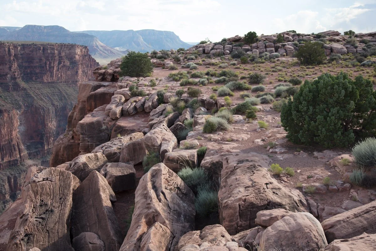
Sunrise – Just 50 yds. to the east of the sunset shot location is the best place for your sunrise shot. There is an outcrop of finger looking rocks that you can stand on and get a great sunrise shot.
EXIF Data
Focal Length – 24 mm
Exposure – 60th sec @ f 8.0
ISO – 100
Date – Feb 8th
Time – 6:19 pm
Best Time of Day to Shoot
What makes Toroweap so special is you get a great sunset shot to the west and then in the morning you walk about 50yds. and you get a stunning sunrise to the east.
Best Time of Year
For the sunset shot, you want the sun setting either directly down the canyon or a little bit to the right (north). From the Toroweap Overlook, your shot is facing west at around @ 240°. This makes the months of September through March good months to shoot the sunset. The sun sets at @ 240° around the third week in December.
For the sunrise shot, you want the sun to rise to the right (south) of the canyon (around 70° - 85°) so the sun will reflect of the north walls to the. This happens in the months of April, May, July, and August.
Another important item to consider are clouds. Clouds will make or break this shot and are essential to a great shot. Watch the weather forecast. If it is going to be clear skies, you may want to return at another date.
Lens(es) Needed
You can use lenses ranging from 16mm – 50mm. The above shot was taken with a 24mm lens.
Birds-Eye View From Google Earth Pro
Permits
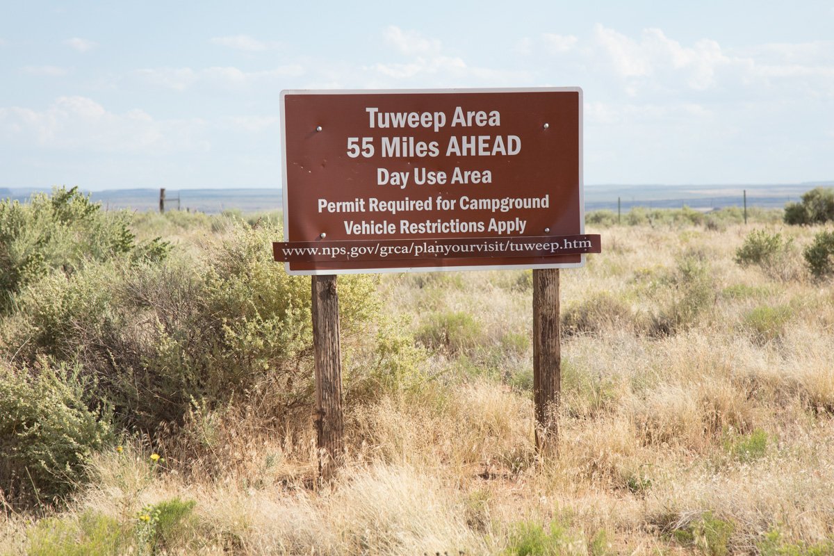
In addition to the standard NPS Park Pass or Site Pass Toroweap (or Tuweep as the NPS has renamed it) also requires a Day Use Ticket or Backcountry Permit (if you are going to stay overnight).
The Day Use Ticket can be secured online. To stay overnight, it is required to get a Backcountry Permit. Permits must be obtained online at least 5 days in advance. Permits cannot be issued at Tuweep. Camping is prohibited on the land adjacent the park and at the airstrip. As of April 2024, the cost is $14 per day.
Click here to obtain a Backcountry Permit - and follow the directions below:
Select Check Availability,
Above Rim Areas - North Rim,
Date,
Group size (1-6 people limited to 2 vehicles; 7-11 people limited to 4 vehicles), and
TCG - Tuweep Campground.
Direction of the Shot
For the sunset shot, the direction of the shot is west @ 240°.
For the sunrise shot, the direction is east by north east @ 55°
Equipment Needed
Other than a tripod, there is no special photography equipment needed unless you plan on doing a panoramic shot. A mentioned, Toroweap is extremely remote and has no water or other resources. Make sure you bring food, water, and shelter.
I would strongly suggest a high clearance 4-wheel drive vehicle for this trip.
Number of Other Photographers to Expect
Even though Toroweap provides one of the most spectacular shots of the Grand Canyon, the remote location and extremely difficult 61 mile drive limits the number of tourists and other photographers. That being said, the shooting area for both the sunset and sunrise spots is very small and will hold only a few photographers.
Weather
Toroweap is in an arid place in the Arizona desert and is 4,000 feet above sea level. Pay close attention to the forecasted temperatures and make sure you have the appropriate clothing. It doesn’t rain much in this part of the southwest, but when it does, the road can be impassable.
Cell Service
I use Verizon, and there is NO cell service anywhere once you leave the highwayor along the road to Toroweap. There is cell service once you get back to the main highway.
Overnight Camping Options
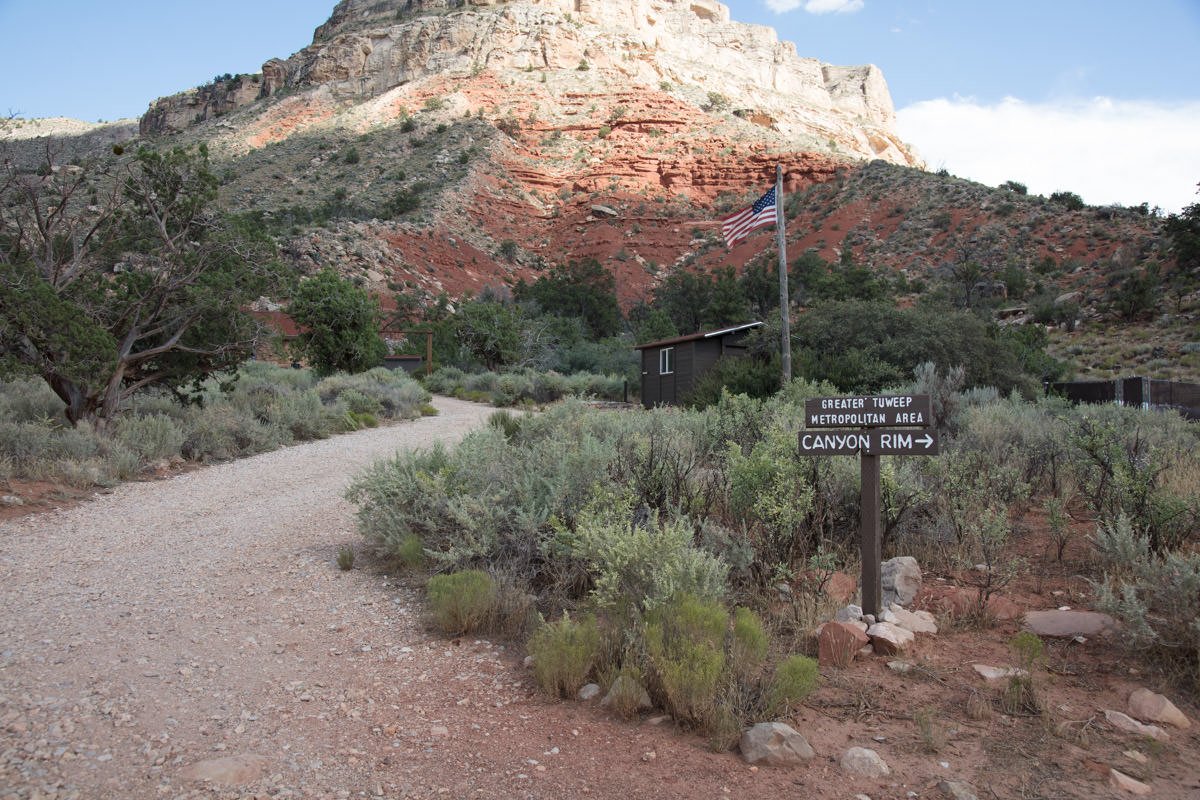
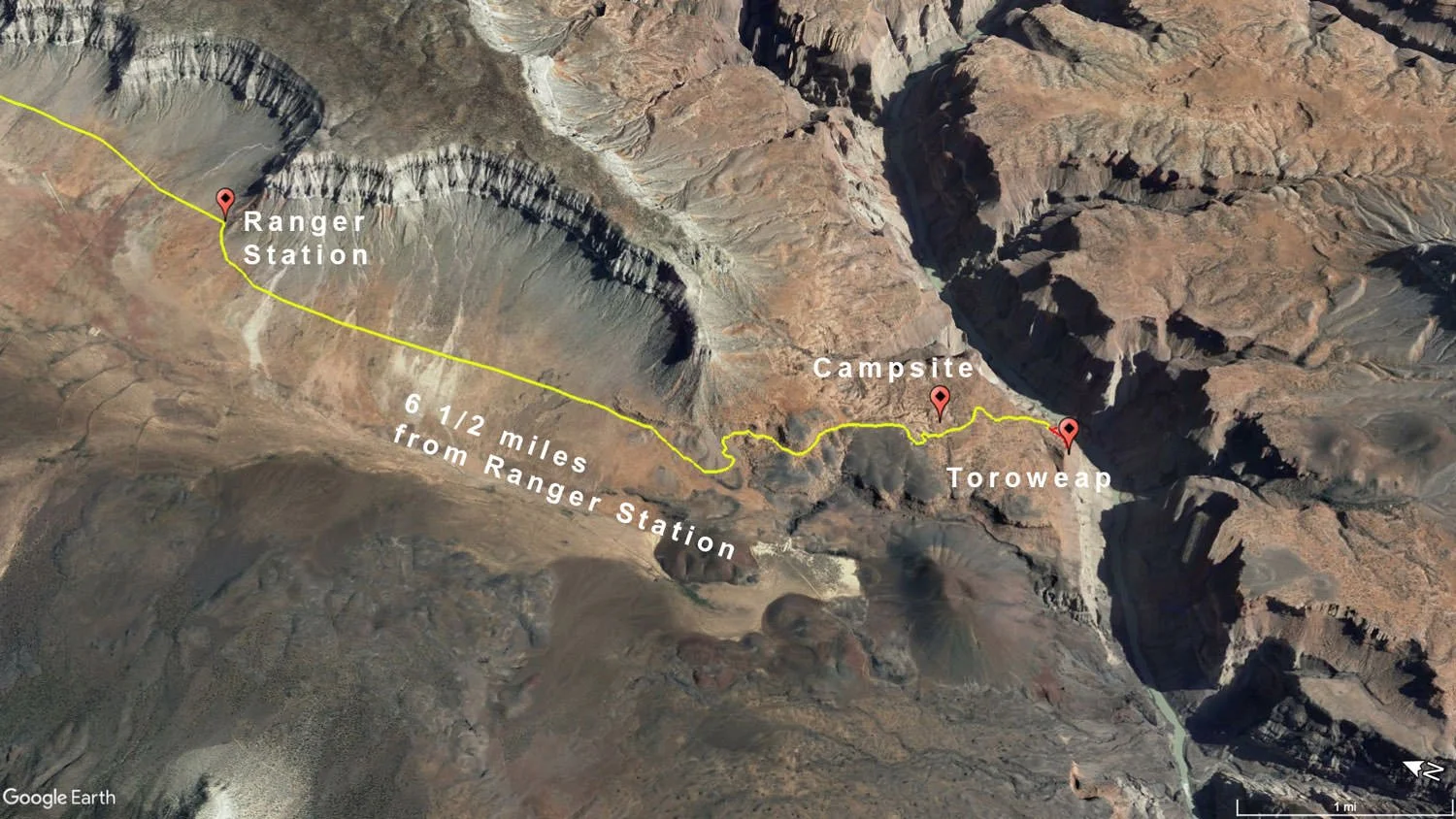
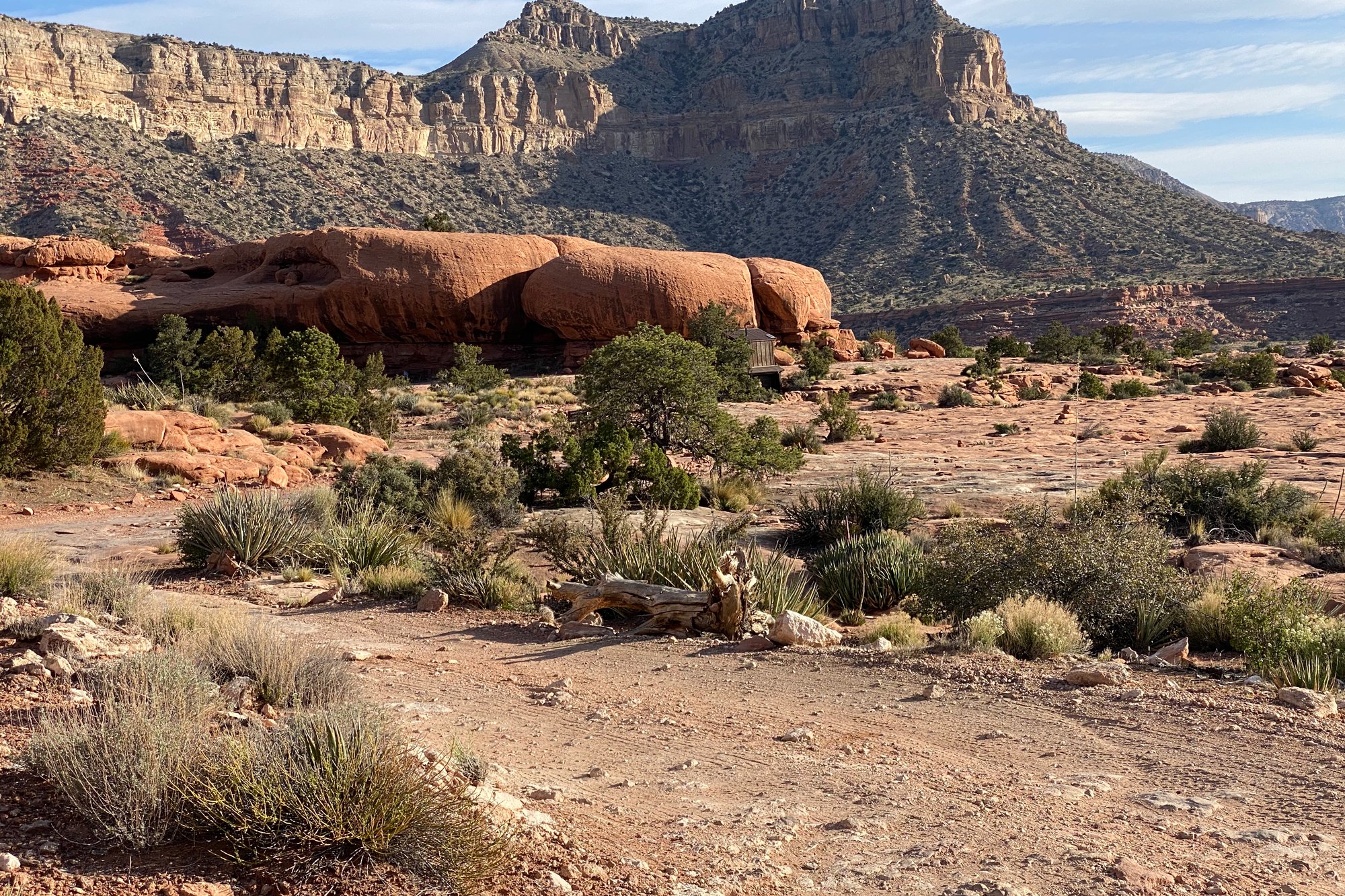
The closest town is Kanab, UT, which is 75 miles away, but takes over 3 hours to get there. If you are going to Toroweap, you most likely will need to camp there for the night. There is a small (9 sites) primitive campsite just 1 mile from the overlook. The Tuweep Campground does not allow fires or charcoal grills, but fuel stoves are allowed. The campsites have picnic tables and composting toilets provided, but no water is available. There is a park station restroom not far from the overlook.
IMPORTANT: As mentioned, camping overnight at Toroweap requires a Backcountry Permit which can be obtained at a NSP information center or sending in a PDF document for confirmation.
Nearby camping and lodging
Camping - click on the campground below for directions
The Tuweep Campground - 1/2 mile from Toroweap Lookout. Permit is required at least 5 days in advance and as of April 2024, the cost is $14 per day.
Nearby Restaurants
There are no restaurants or other resources anywhere around Toroweap.The closest town is Kanab, UT, which is 3 hours away.
Area Guides and Workshops
None