
Falls Creek Falls

FALLS CREEK FALLS
South Central Washington
Falls Creek Falls is a wonderful set of cascading waterfalls located in south central Washington and are among the largest and most powerful waterfalls in the state. The falls are a series of 4 separate cascades adding up to over 200ft. However, for most viewers you can only see the lower 3 falls. From a photography standpoint the best views are down at the creek.
Location summary by Tim Wier
Trail Difficulty - MODERATE TO CHALLENGING
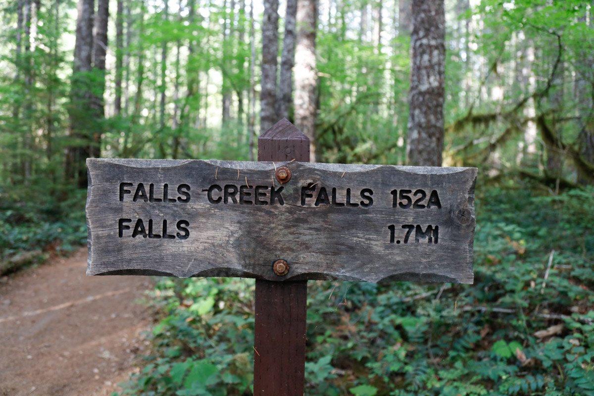
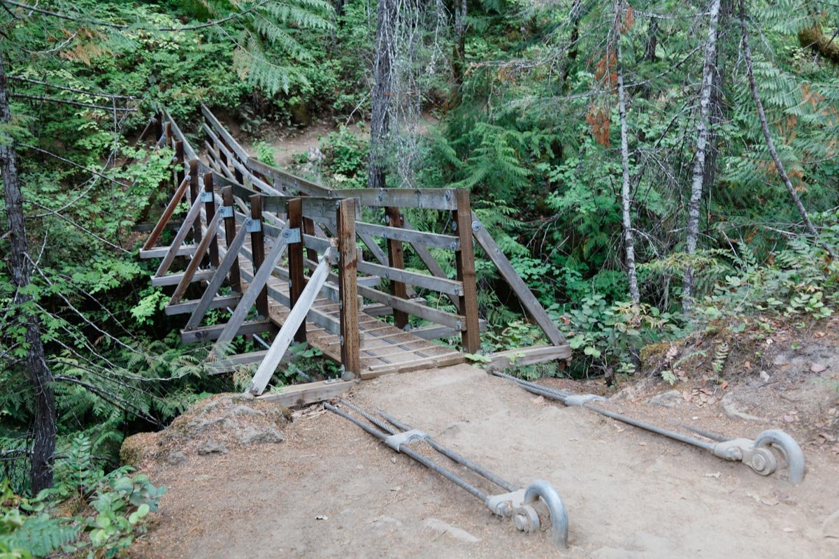
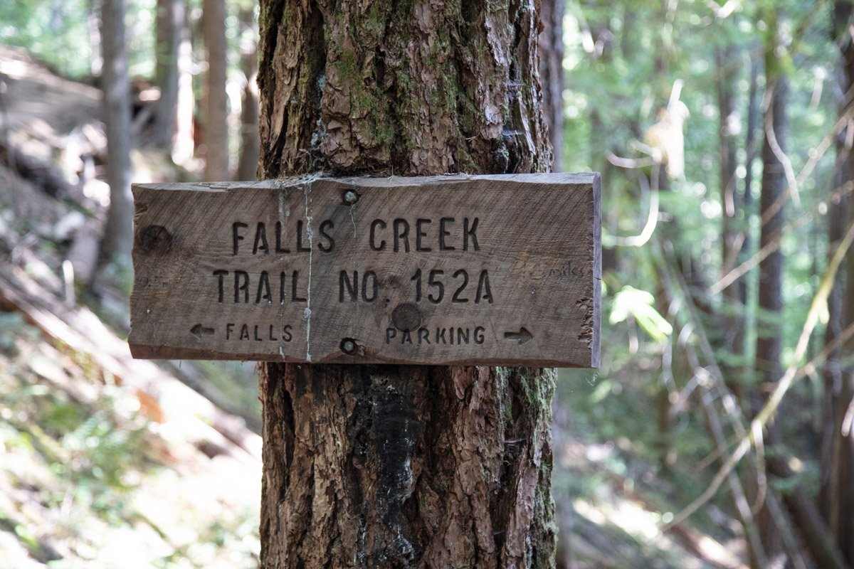
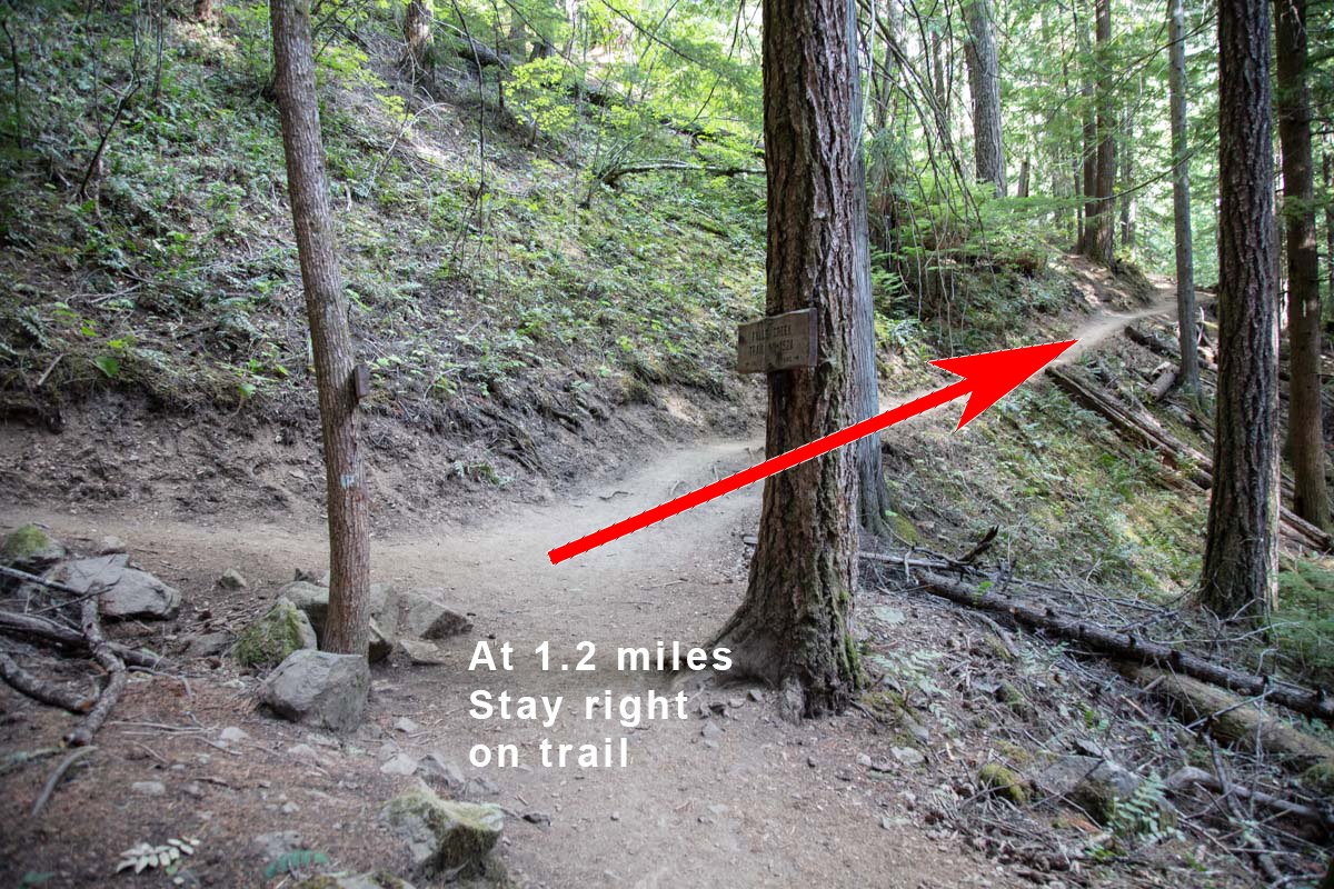
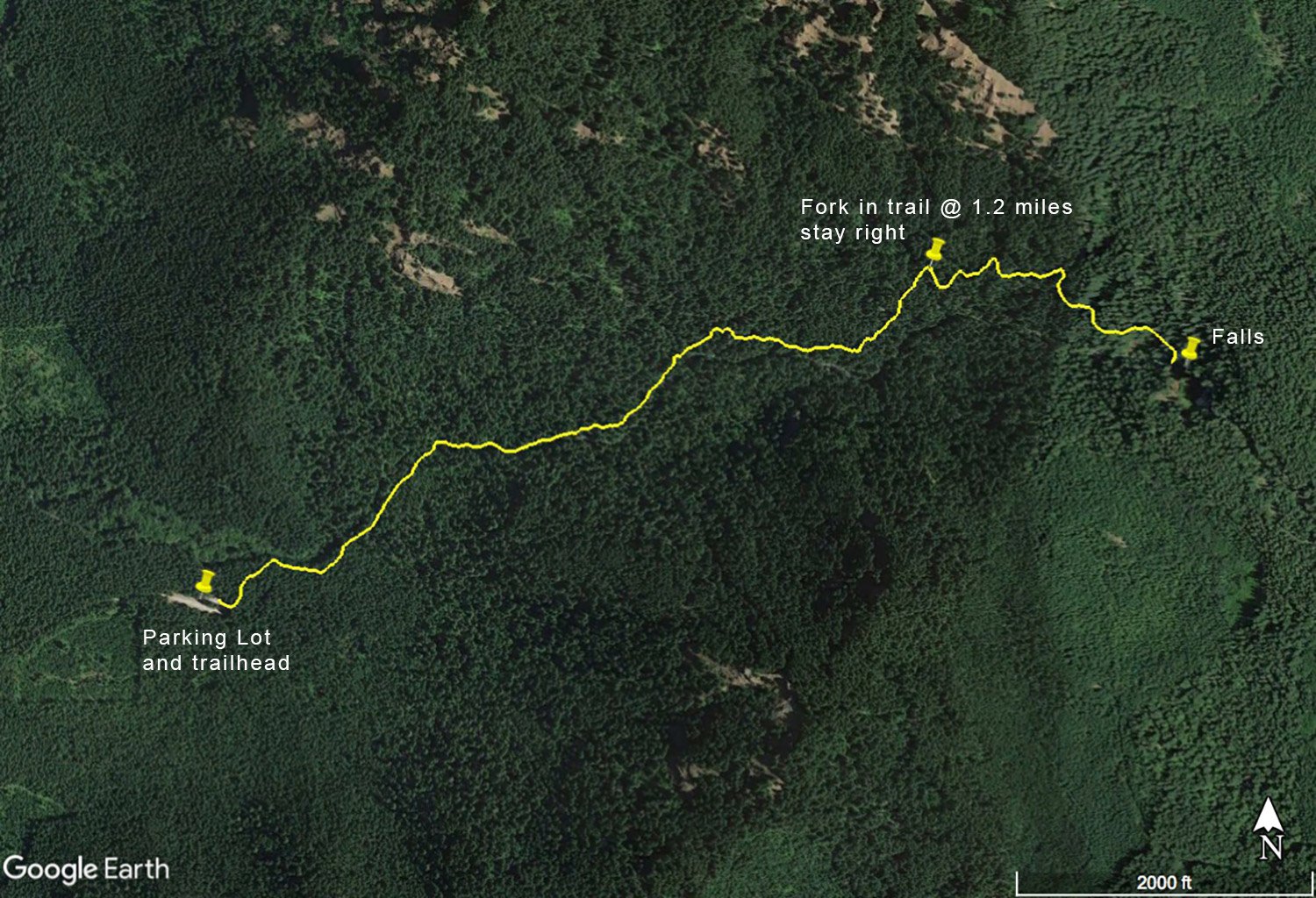
I would rate the difficulty of this trail as a 3.5 on a scale of 1-5 (with 5 being most difficult). The hike to these beautiful falls is a moderately steep 1.7 mile (600 elevation gain) hike from to the parking lot. The trail is well marked and and fairly straightforward with a fork at about 1.2 miles from the trailhead. At the fork, take a right for .5 miles and you will arrive at the falls.
If you want to venture down to the creek - there is a path (but not very well defined) about 30 yds back from the main viewing area. The path is a bit dicey at times - and you will be crawling over fallen logs and slick spots down to the creek. However, from the creek you will have a MUCH better view and a better opportunity to produce a special image. This path is not for everyone and I would advise going with another person to help navigate.
GPS Coordinates & Elevation
2,000 ft Elevation
View In Google earth
Download KMZ Trail File
Click Here to download the KMZ file for this location.
Directions
CLICK HERE to get driving directions to Falls Creek Falls.
The closest town to Falls Creek Falls is Stevenson, WA (17.2 miles south).
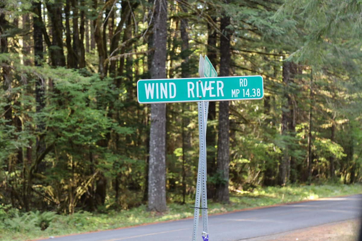
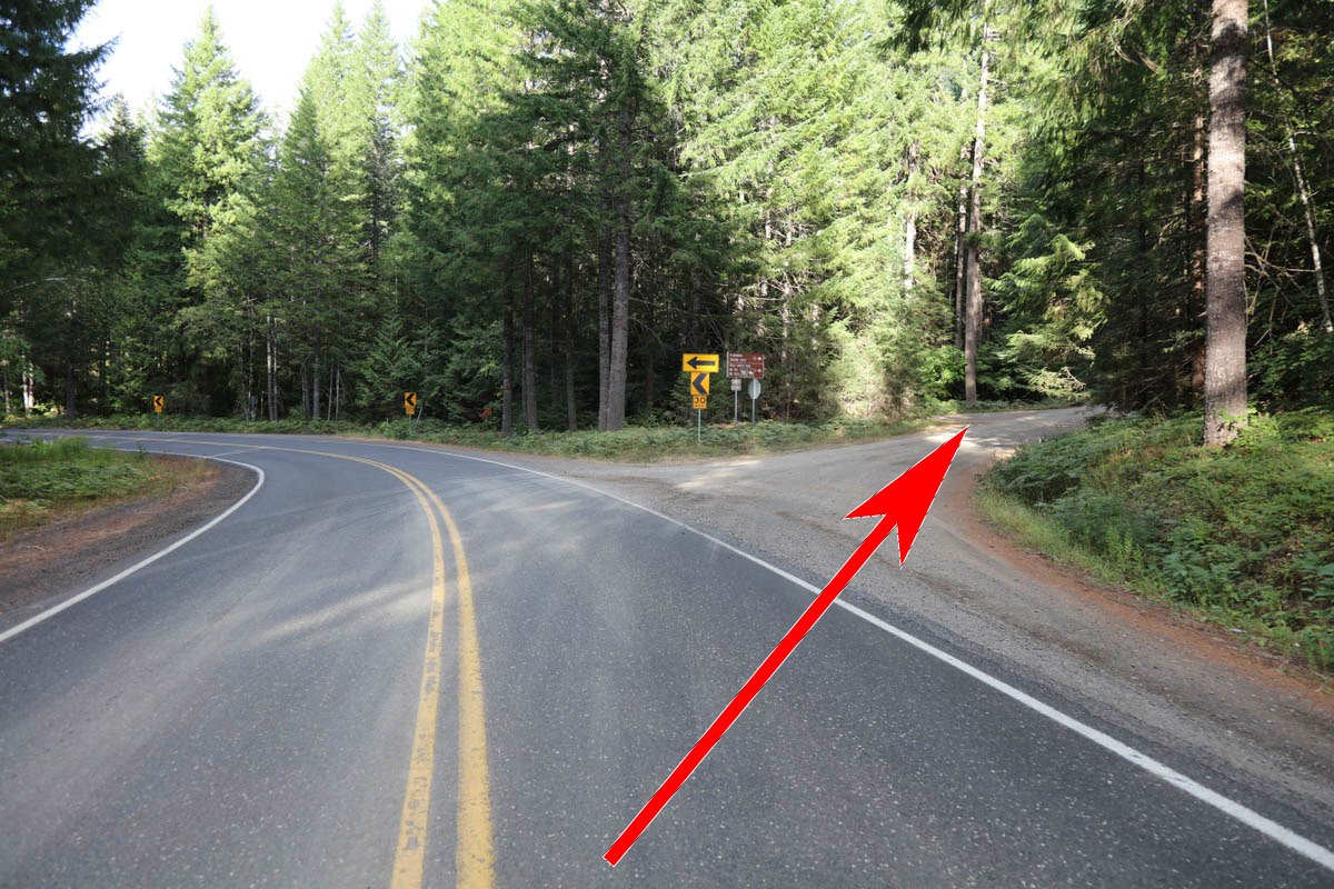
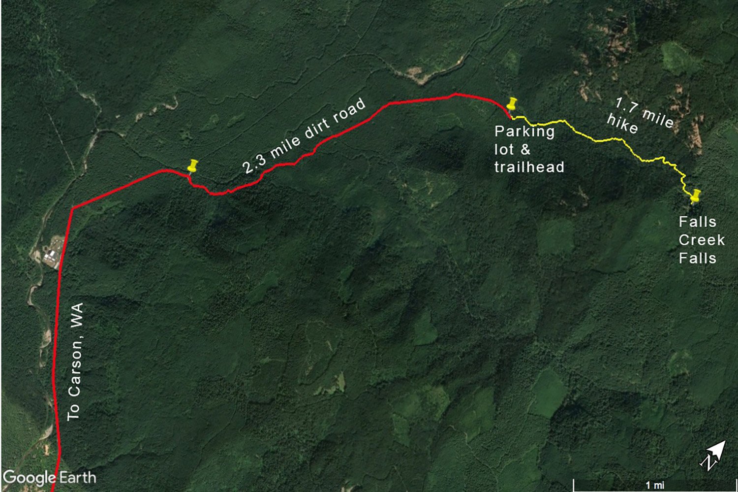
From Stevenson, WA, drive 3.2 miles east on WA-14 and take a LEFT at the turn-off toward Carson, WA (Wind River HWY). From Carson, travel north 13.4 miles on Wind River HWY and look for the Carson National Fish Hatchery Visitor Center on the left. About a 1/4 mile past the fish hatchery turn right onto Meadow Creek Rd/NF-30. Travel east on Meadow Creek Rd/NF-30 for .8 miles and turn right on NF-3062 (look for the sign for Falls Creek Falls).
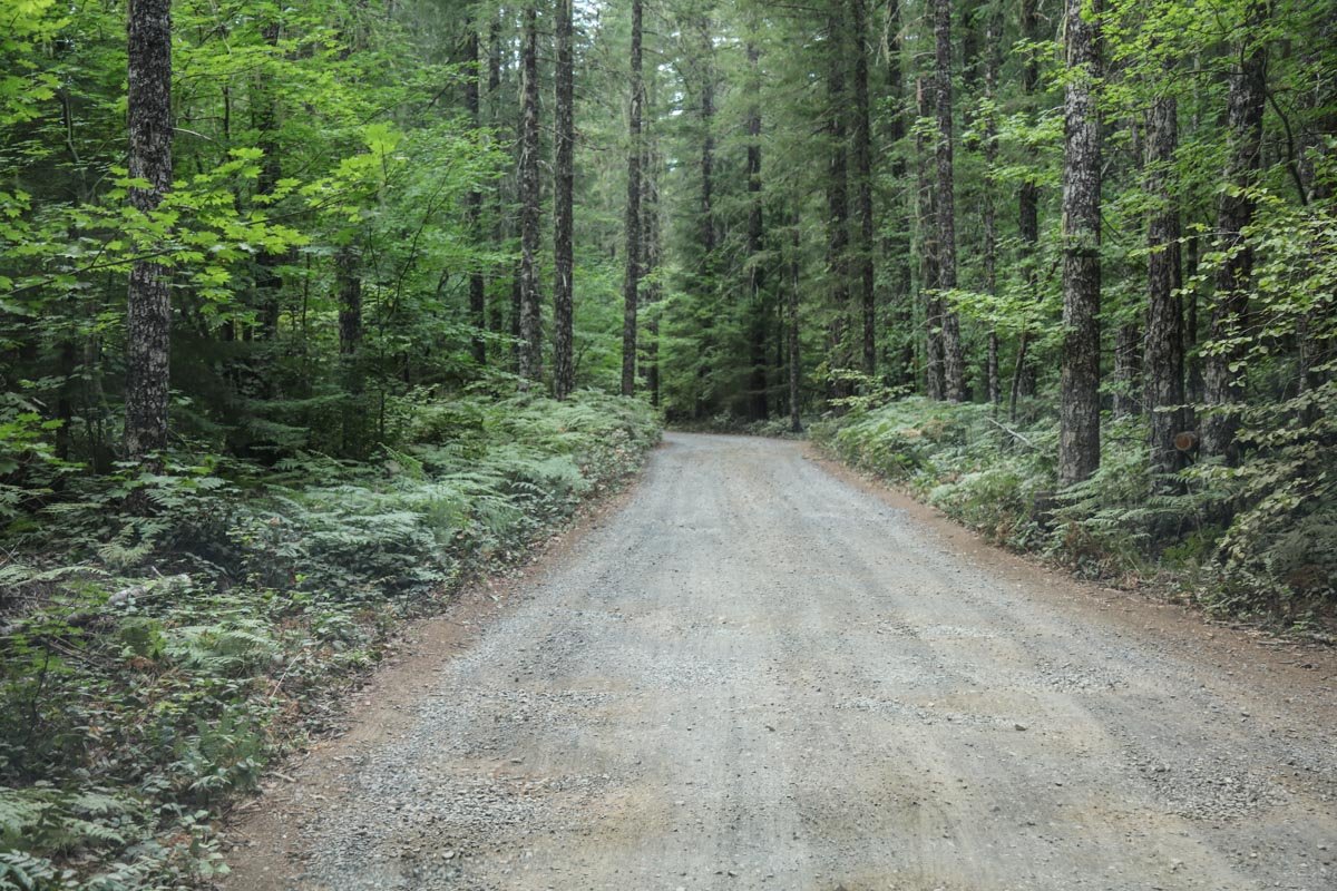
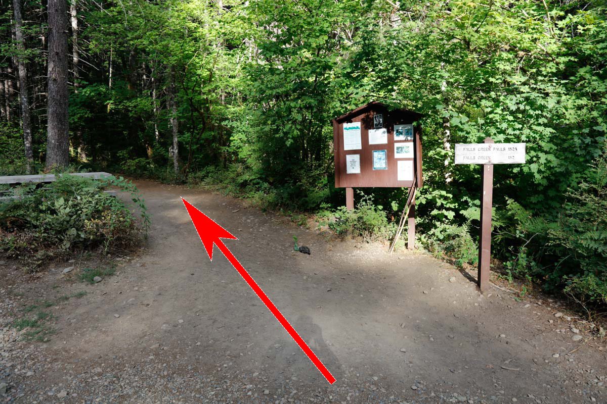
Travel on the dirt road that is NF-3062 for 2.3 miles to get to the Falls Creek Falls parking lot /trailhead. The road is bumpy and has many pot holes along the way, but a car can easily manage it. The parking lot holds about 30 vehicles and the trail head is well marked just left of the rest room.
The hike is 1.7 miles, mainly uphill running through forest. At 1.2 miles you will come to a fork in the trail - stay right and the falls are .5 miles up the trail. The elevation gain is about 600ft.
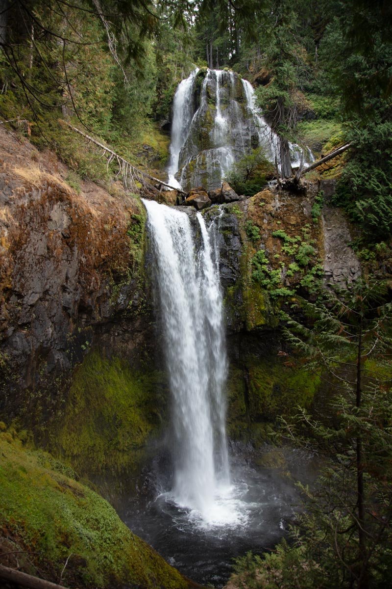
To get down to the creek, there is a path about 30 yds back from the main viewing area. The path can be dicey as you will be crawling over bolders, fallen trees and mossy areas down to the creek.
Photography Tips
There are 2 different places to shoot the Falls Creek Falls.
The main viewing area (at the end of the trailhead) is fairly straightforward and you will be shooting wide angle to capture both the top and bottom of the falls. You will need a ND filter to slow the shutter speed down to 1/2 or more.
If you want to venture down to the creek, you will have a MUCH better opportunity to produce a special image. This path is not for everyone and caution is required. If you are there in spring and the water flow is strong, it may not be safe to venture down to the creek. Also, be prepared to shield your camera / lens, and consider bringing towels or micro cloths to dry your camera / lens.
Best Time of Day to Shoot
The sun rises in the summer directly in front of the falls - so the best time to shoot is either on an overcast day or early morning. Once the sun crests the falls are blown out until late afternoon or evening.
Best Time of Year
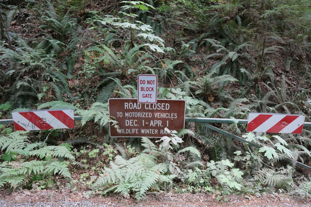
Spring, summer and fall are all good times to shoot these beautiful falls. However, spring to early summer would be the best as the water flow from the creek is much more impressive. The road to the falls is closed from Dec 1st t0 April 1st.
Lens(es) Needed
The falls are tall and narrow and require different lenses depending on if you shoot from the main viewing area or down at the creek. I would suggest bring a 16-35mm and a 24-70mm lens if you want to do a compression shot.
A perspective control lens would also be a benefit as you are pointing up to get the top of the falls.
Birds-Eye View
Permits
There are no permits required.
Direction of the Shot
The direction of the shot from the main viewing area is southeast around 120°. The direction from the creek is east @ 100°.
Equipment Needed
You will need a tripod, a polarizer, and a neutral density (ND) filter to reduce your shutter speed to ½ second or longer to create the silky water flow on the falls. A perspective control lens would also be a benefit as you are pointing up to get the top of the falls. As mentioned you might consider bringing towels or micro cloths to dry your camera / lens due to the spray from the falls.
Number of Other Photographers to Expect
Falls Creek Falls is a beautiful location for both photographers and outdoor enthusiasts. Depending on the time of year and the day of the week you may encounter upward of 30 folks at the falls. However, most if not all will be tourists just out to enjoy the hike and the view.
Weather
It rains a great deal in this part of the country. If it is raining, the trail to the falls can become slick and muddy.
Cell Service
I have Verizon and my cell service lasted to the end of the town of Carson, WA. After that, there was no cell service.
Lodging & Camping
The closest town is Carson, WA (17 miles), which has limited places to stay. The next larger towns are Stevenson, WA (21 miles south and west) and Cascade Locks, OR (24 miles south and west across to Oregon) which have lots of lodging.
The closest camping is at Beaver campground (4.7 miles south off of Wind River HWY). It is a nice facility, but is closed in the winter & early spring. Other camping spots are the Marine Park campground in Cascade Locks (25 miles south) and Eagle Creek campground (30 miles south and then west). Marine Park campground is right on the Columbia River (on the Oregon side) and has showers and wifi.
Nearby camping and lodging
Camping - click on the campground below for directions
Beaver Creek campground – 4.7 miles south
Marine Park Campground – 25 miles south in Cascade Locks
Nearby Restaurants
Stevenson, WA, is a nice little town with some nice places to eat. I have had many a good meal and cold beer at the Big River Grill directly across for the Stevenson Elementary School. It is a nice place with good food and friendly folks. Also Joe’s El Rio Mexican Café across the street has very nice people, pretty good Mexican food, and great margaritas.
Cascade Locks, OR, is also a nice little community. My favorite place to eat is the Cascade Locks Ale House. They have GREAT pizza with a good selection of local brews.
Nearby Restaurants - click on the restaurant below for yelp review
Big River Grills
(509) 427-4888
192 2nd St, Stevenson, WA
El Rio Mexican Cafe
(509) 427-4479
193 2nd St, Stevenson, WA
Area Guides and Workshops
Mark Metternich
www.markmetternich.com
Mark@MarkMetternich.com