
Punch Bowl Falls
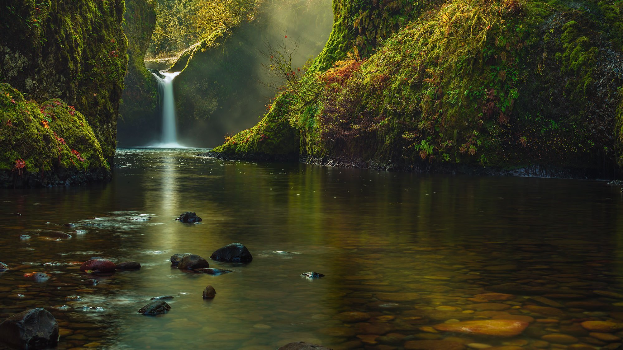
PUNCH BOWL FALLS
Columbia Gorge, OR
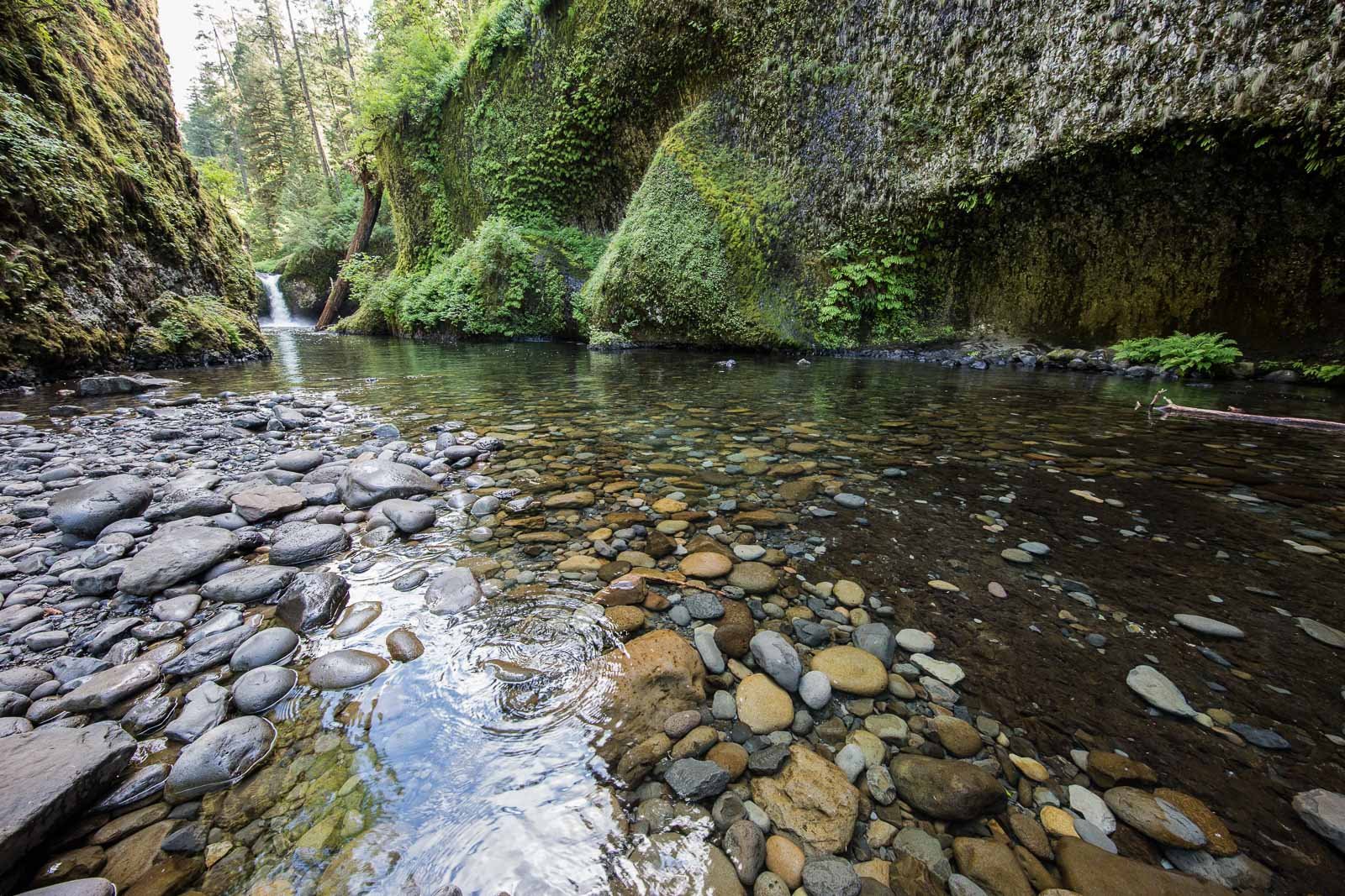
Punch Bowl Falls is one of the most beautiful waterfalls in the Columbia Gorge. Rarely does a year go by without seeing Punch Bowl Falls featured on a major calendar or showing up on a list of favorite destinations.
There are two classic vantage points to photograph this awesome waterfall: one from above (Upper) and one from below (Lower). The image above is from Lower Punch Bowl Falls. Because of the picturesque natural beauty there are many, many tourists and photographers that make the trek to this location. If you want a great shot without competing for space, you need to arrive early in the morning.
Images and location summary by Tim Wier
Trail Difficulty - MODERATE TO CHALLENGING
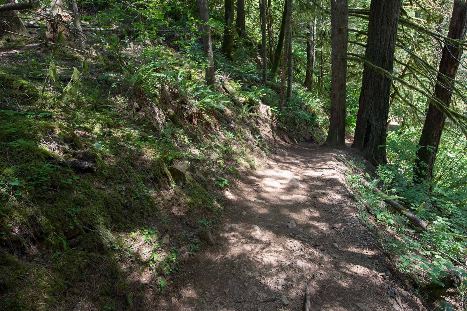
I would rate the difficulty of this trail as a 3 on a scale of 1-5 (with 5 being most difficult). The hike to Lower Punch Bowl Falls is approx. 2 miles from the beginning of the Eagle Creek Trailhead with an incline of 500ft. The rocky dirt trail is well marked, but has some difficult parts along the way. The trail runs along a steep canyon above the Eagle Creek and in places has a 200ft. drop to the river.
From the Eagle Creek trail, the ¼ mile hike down to the Lower Punch Bowl Falls (on Eagle Creek) is steep in some places and slick around the wet rocks in the creek.
GPS Coordinates & Elevation
44 Ft Elevation
View In Google earth
Download KMZ Trail File
Click Here to download the KMZ file for this location.
Directions
CLICK HERE to get driving directions the Eagle Creek trailhead parking lot.
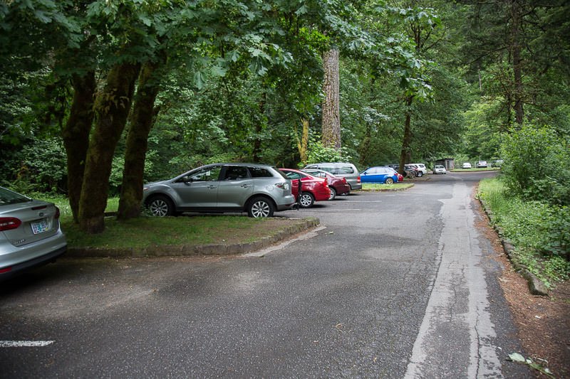
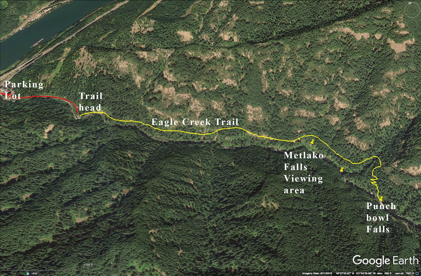
From Portland, OR, travel east on I-84 for approx. 35 miles and take the exit 41 (Eagle Creek Ln). Once you exit, take a right turn and then a quick left into the parking lot next to the Cascade Hatchery. The parking lot holds about 25 cars.
From the parking lot, walk about 1/2 mile south along a paved one-lane road that goes along the Eagle Creek. There are some picnic tables and limited parking spaces on the walk to the Eagle Creek trail head. If you arrive early enough you can park closer to the trailhead and save yourself the extra ½ mile hike.
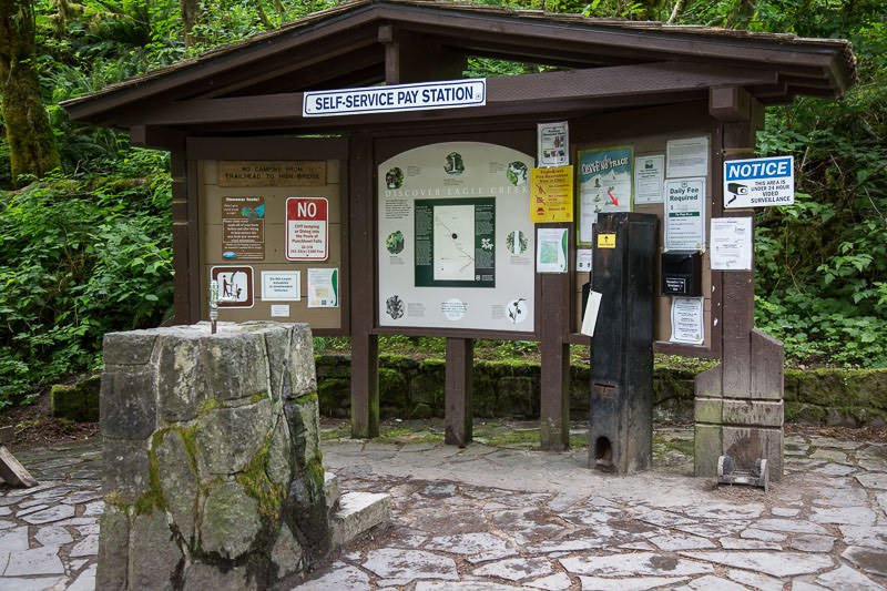
Once you have paid ($5 day) and displayed your National Forest Pass, walk to the end of the road and find the Eagle Creek Trailhead (Eagle Creek Trail #440), just to the right of the Forest Service fee area. If you have a GPS, set it at this point.
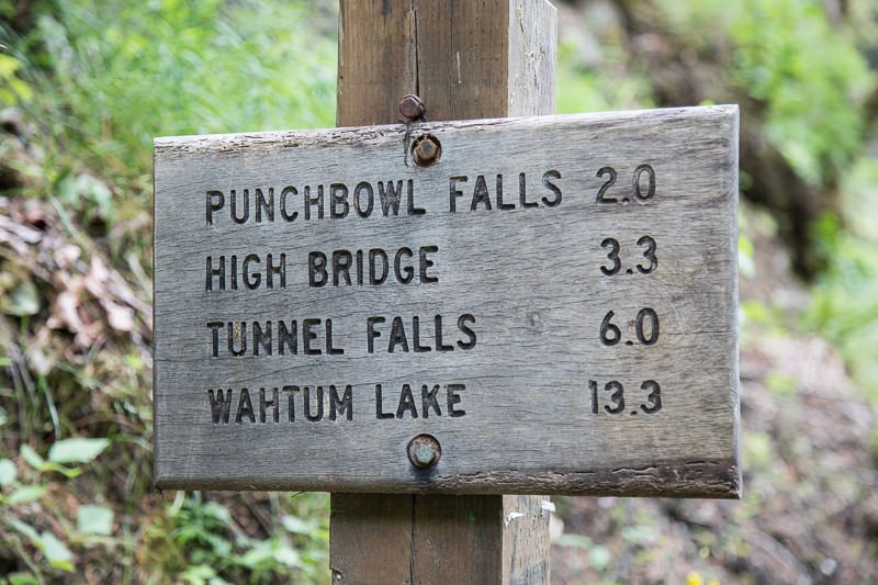
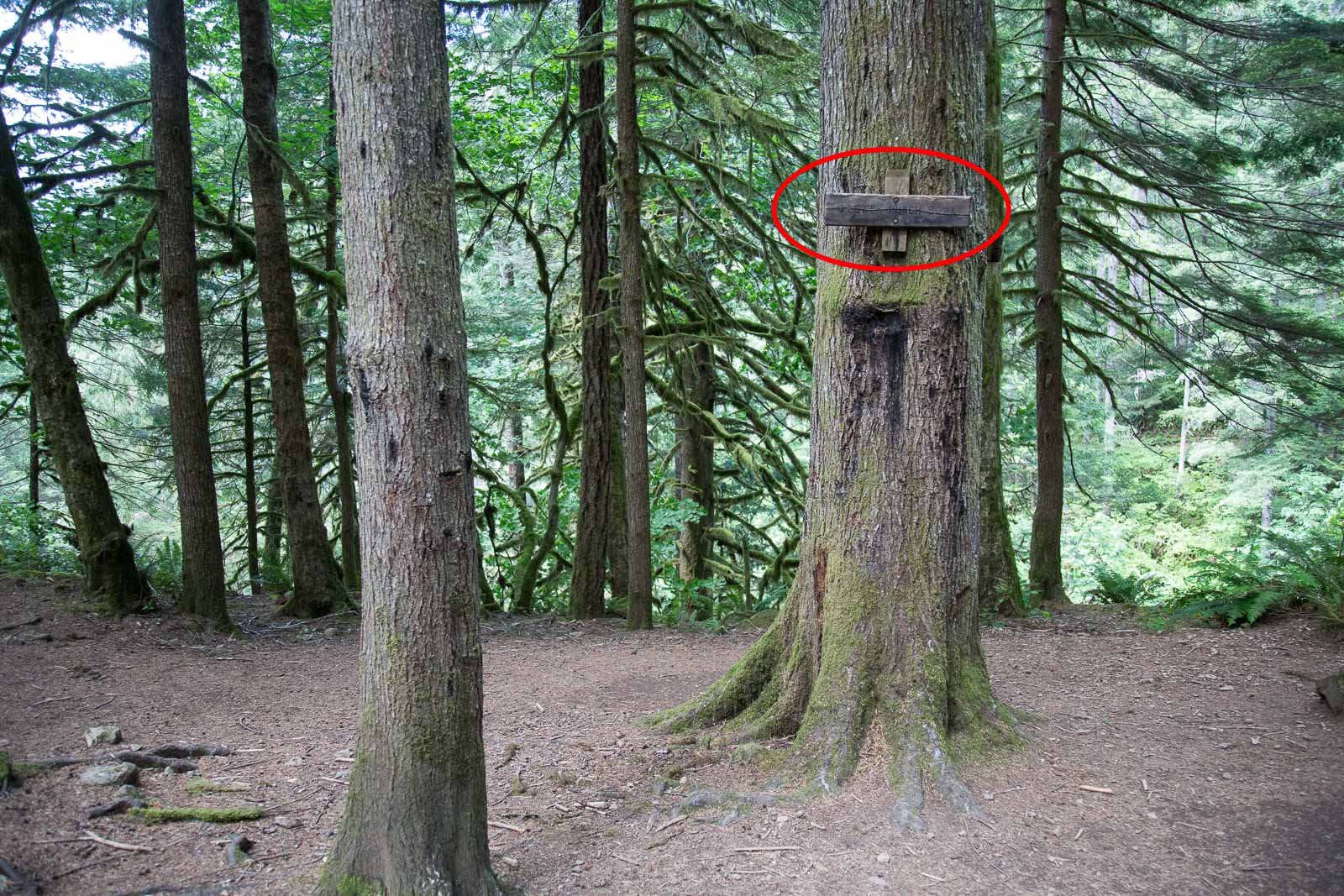
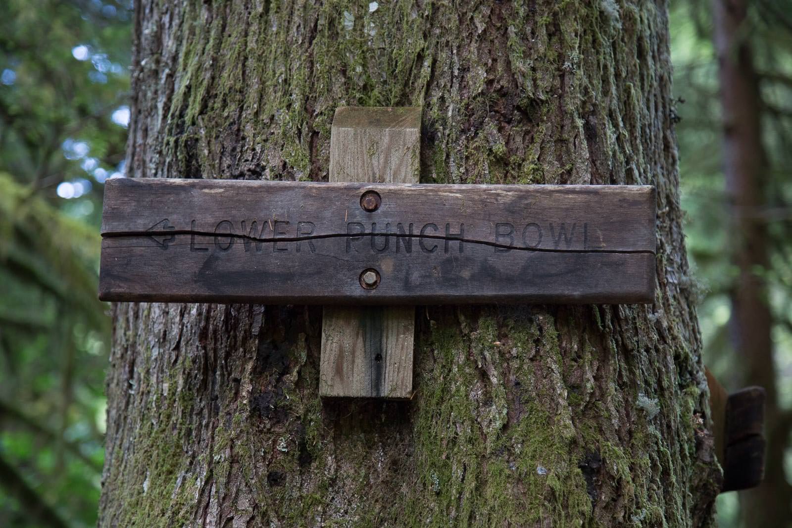
Hike up the trail for about 1.8 miles and start to look for a large opening off to the right of the trail, which is marked by a small wood sign that reads “Lower Punch Bowl Falls.” The sign is attached to a tree about 8ft. above the trail and is easy to miss.
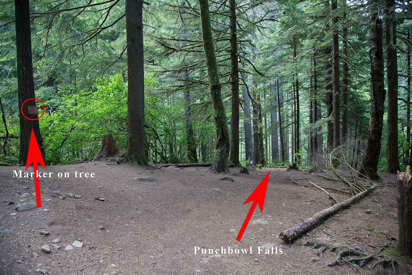
Once you find the large opening on the right and the sign that says “Lower Punch Bowl Falls,” walk down the well-marked path for about 75ft. (stay to the left). You will then walk down a well-marked trail with large wood plank steps down to the riverbed. Note: The walk down the steps and the rocks/boulders on the riverbed can be VERY slick. BE CAREFUL.
Once you are down to the riverbed, keep walking straight for about 60yds. Just around the bend is the magical spot know as Punch Bowl Falls. Depending on the time of year, the river can be from ankle to knee high.
Photography Tips
There are lots of ways to shoot Punch Bowl Falls: wide angle, standard, or even a compression shot. However, most of the shots will be taken while standing in the creek (the rocks are very slick, and it’s easy to fall). Slow and steady.
I prefer the shot with the sunlight peaking through the water spout. This soft light only last for a few moments and is best with one a cooler morning with mist or fog.
EXIF Data
Focal Length – 50 mm
Exposure – 2 sec @ f 8.0
ISO – 100
Date – Oct 25th
Time – 7:55 am
Best Time of Day to Shoot
For me the best time to shoot Punch Bowl Falls is in the early morning (an hour or so after sunrise) before the sun reaches over the ridge to the southeast and blows out the scene. If you arrive very early, there is often a mist/fog that sits just above the falls until the sun burns it off. The sun rays on the mist/fog can add to the photographic opportunity.
Best Time of Year
Spring, summer, and fall are all good times to shoot these wonderful falls. However, late fall would be the very best time to shoot, as the underbrush and trees around the falls add an extra punch to the scene.
Lens(es) Needed
The above shot was taken with a 50mm lens. Depending on the composition you are looking for, you can use a 35-135mm lens.
Birds-Eye View
Permits
A National Forest Pass is required. The day pass is $5.
Direction of the Shot
The direction of the shot is south at 160°.
Equipment Needed
You will need a tripod, a polarizer (to reduce the glare from the creek), and a neutral density (ND) filter to reduce your shutter speed to ½ second or longer to create the silky water flow.
Another item to consider are waders/wet shoes and micro spikes, as you will most likely be walking/sitting in water.
Number of Other Photographers to Expect
Lower Punch Bowl Falls is a very popular location with tourists and photographers. Unless you arrive very early, you will have to share the location with many other people.
Weather
It rains a great deal in this part of the country, so make sure you travel with rain gear. It can get cold in spring and fall, and winters are usually wet and very cold. Make sure you travel with the appropriate cold weather equipment in spring, fall, and winter.
Cell Service
I use Verizon, and there is NO cell service at this location. Cell service is available once you get back to the parking lot.
Lodging & Camping
Punchbowl Falls is on the Eagle Creek trail. The closest towns are Cascade Locks, OR (3 miles east) and Stevenson, WA (6.5 miles east across into Washington). The closest city is Portland, OR (45 miles west). The Portland metropolitan area has many choices for lodging. Cascade Locks and Stevenson are smaller towns but do have several lodging options.
For camping, I stay at either the Eagle Creek campground (which is just off of the Eagle Creek trailhead parking lot) or Ainsworth State Park (11 miles west). Eagle Creek campground is very convenient, but small (16 sites), does not have RV hookups, and fills up quickly. Ainsworth State Park is a traditional campground with about 40 RV hookups and tent sites.
Nearby camping and lodging
Camping - click on the campground below for directions
Nearby Restaurants
Cascade Locks, OR, is a nice little community. My favorite place to eat is the Cascade Locks Ale House. They have GREAT pizza with a good selection of local brews.
Stevenson, WA, is a nice little town with some good places to eat. I have had many a good meal and cold beer at the Big River Grill directly across for the Stevenson Elementary School. It is nice place with good food and friendly folks. Also Joe’s El Rio Mexican Café across the street has very nice people, pretty good Mexican food, and great margaritas.
Nearby Restaurants - click on the restaurant below for yelp review
Cascade Locks Ale House
(541) 374-9310
500 NW Wanapa St, Cascade Locks, OR
(971) 231-4599
515 NW Portage Rd, Cascade Locks, OR
Big River Grills
(509) 427-4888
192 2nd St, Stevenson, WA
El Rio Mexican Cafe
(509) 427-4479
193 2nd St, Stevenson, WA
Area Guides and Workshops
If you were looking for a GREAT photography guide for Pacific Northwest (Oregon and Washington areas) - I can highly recommend Mark Metternich. I have taken workshops with Mark in the past and he has been hosting workshops in the Pacific Northwest for many years.
Mark knows all the VERY best places to take you and just the right time to be there - to help you get the shot. He is a great photographer, an expert at photoshop, an excellent guide/instructor and a super nice guy.
Mark Metternich
www.markmetternich.com
Mark@MarkMetternich.com